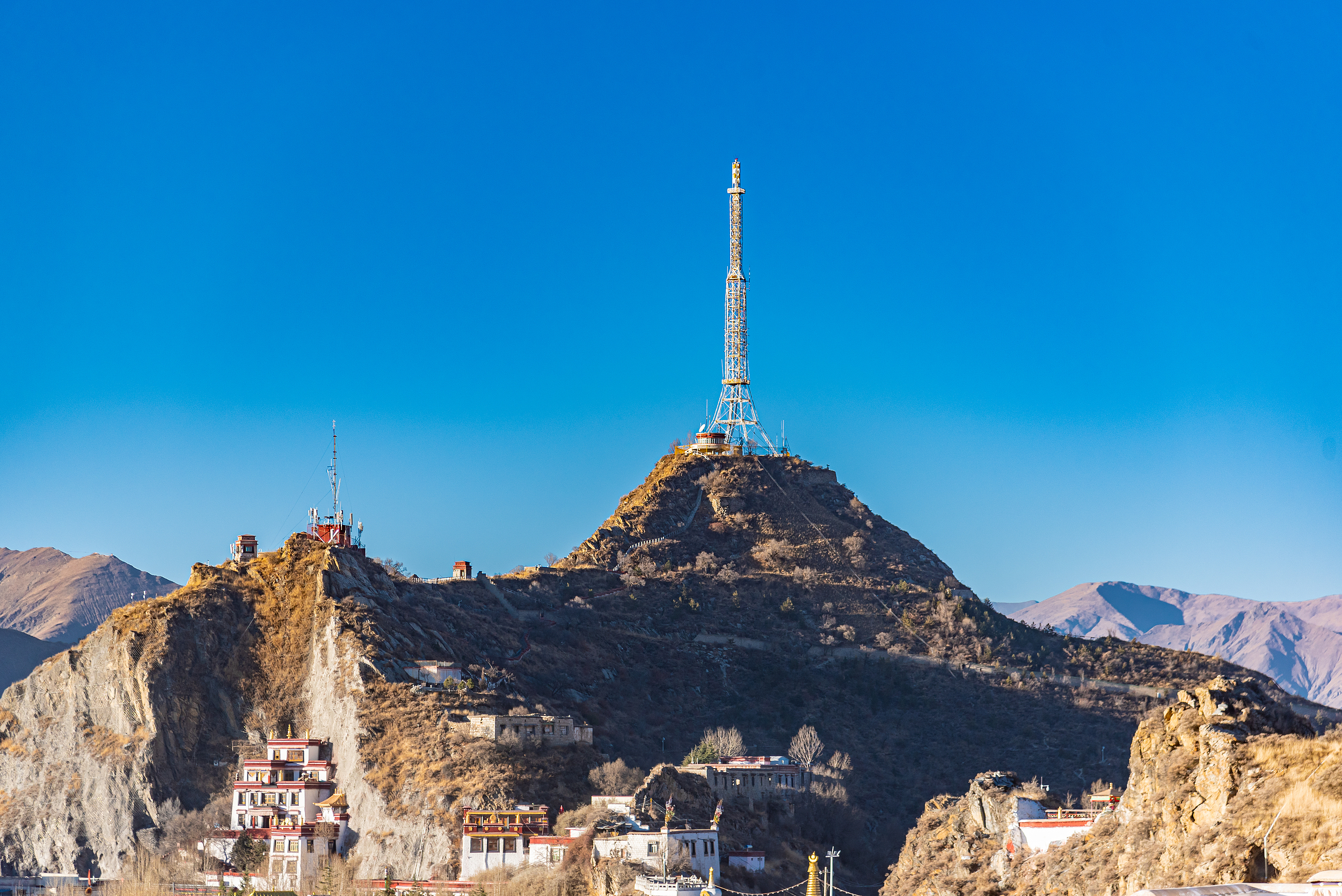
Chakpori, known as the Tibetan name for the mountain’s corner, is one of the four sacred mountains of Tibet, with an altitude of 3725 meters.Chakpori is roughly S-shaped, with two peaks, east and west. On the mountain is the Chala Lupu Monastery, the residence of early Tibetan medical lamas. In the late 17th century, Desi Sangye Gyatso built the Menba Zhacang (medical college) here, making it an important center for the development of Tibetan medicine. Legend has it that this is where Princess Wencheng prayed eastward when she missed her hometown, adding to its sacred atmosphere. The Thousand Buddha Cliff on the west side is one of the oldest cliff carvings in Tibet, with over 5000 Buddha statues of various forms carved on nearly two kilometers of cliff face. Chakpori is also one of the best locations for photographing the Potala Palace; the viewing platform halfway up the mountain is the spot featured on the 50 RMB banknote. Every year, numerous pilgrims and photography enthusiasts come to experience its unique religious atmosphere and magnificent scenery.
归档: Attractions
-
Namtso Tashi Peninsula
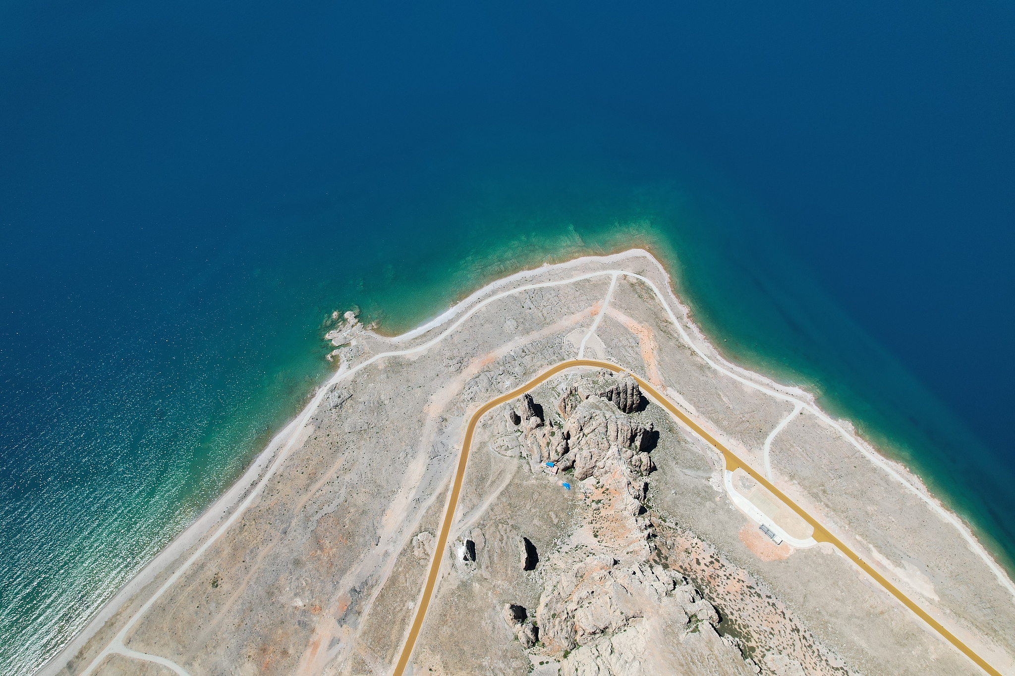
The Zhaxi Peninsula, also known as the Auspicious Love Island, is located in Dangxiong County, Xizang. It is the largest peninsula in Namtso and an important tourist attraction for visiting Namtso. The Zhaxi Peninsula is located at the southeast end of Namtso Lake and extends northward into the lake. It is a peninsula of about 10 square kilometers made of limestone. In the middle is a small hill several dozen meters high. At the north end, there are countless stone pillars and strange stone peaks. There are also natural stone bridges connecting the peaks. Because it has been eroded by the water of the lake for a long time, there are many quiet caves on the island, which are full of stalactites, forming a unique karst landform. Such a strange and colorful landform on Zhaxi Island is a wonder. Zhaxi Peninsula is the most concentrated place for religious activities in Namtso. There is Zhaxi Temple on the peninsula (Zhaxi means auspicious in Tibetan), which is still filled with incense and morning bells. There is a large cave beside the circumambulation road of the peninsula, called the Lotus Cave. It is said that there is a naturally formed Lotus Pagoda in the cave. Along the circumambulation path of the peninsula to the lake, the first thing you see is the welcoming stone on the roadside. Countless banners as long as the welcoming stone of the Zhaxi Peninsula float down from the top of the mountain, decorating the huge stone with colorful colors. The welcoming stone is two pieces of dissolved stone, also known as the husband and wife stone, and is the door god of Namtso.
-
Sejila Mountain
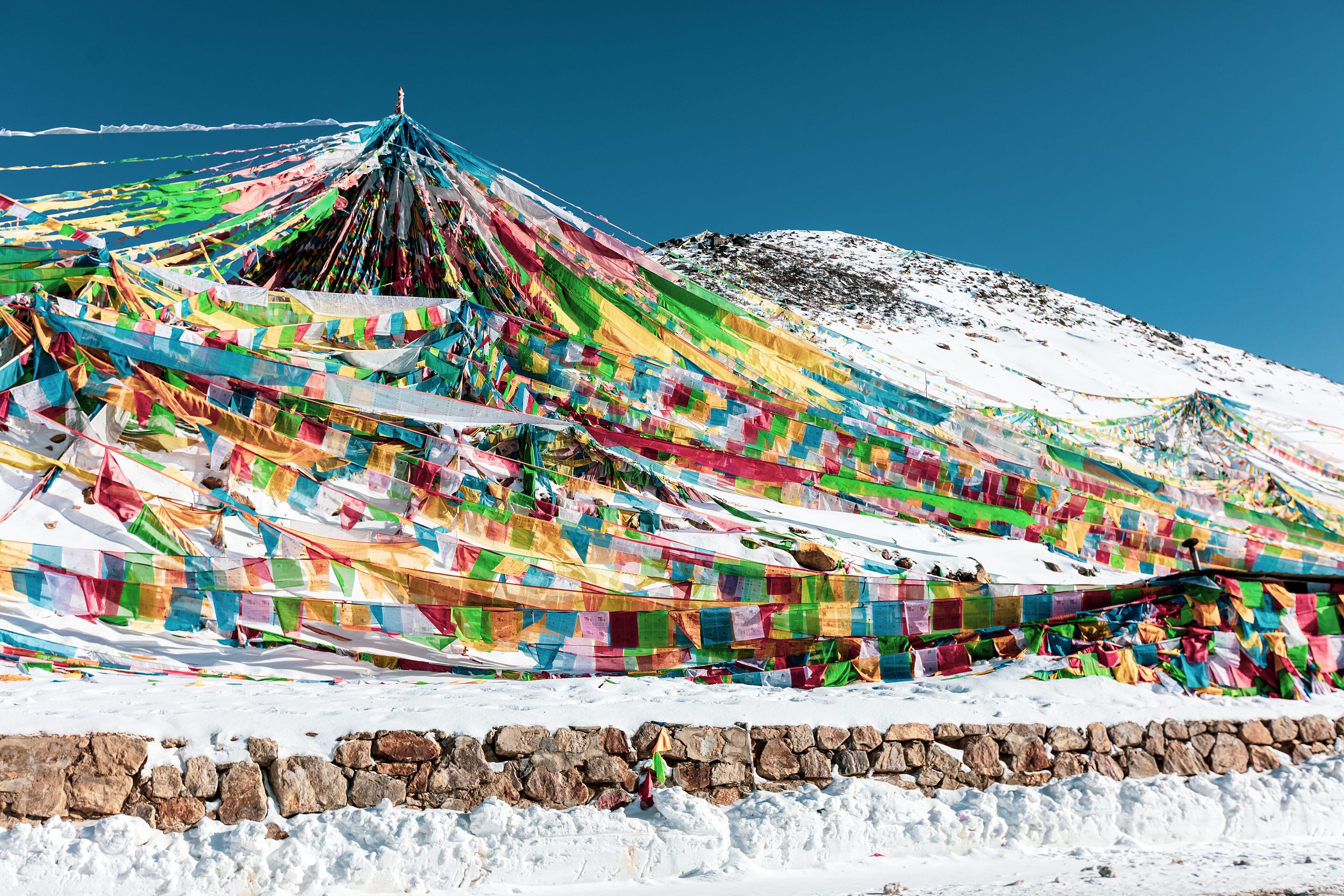
Sejila Mountain is located on the southeast side of Bayi Town. When walking on the Sichuan-Tibet line, Bomi will pass by on the Bayi Road. It is a famous landmark on the Sichuan-Tibet line. The Sejila Mountain Pass is 4,728 meters above sea level, with a wide field of vision. You can overlook the Lulang Forest Sea and the Nanga Bawa Peak behind it. It is a good place to take pictures. The rhododendrons all over the mountains are also a famous landscape of Sejila Mountain. From April to June every year, from the foot of the mountain to the mountainside, as many as two dozen kinds of rhododendrons gradually bloom in the mountains, with various colors and shapes, bright and dazzling. Combined with the colorful prayer flags flying in the mountain pass, the scenery is gorgeous. When tourists pass by, they will inevitably stop and watch.
-
La Ghen La
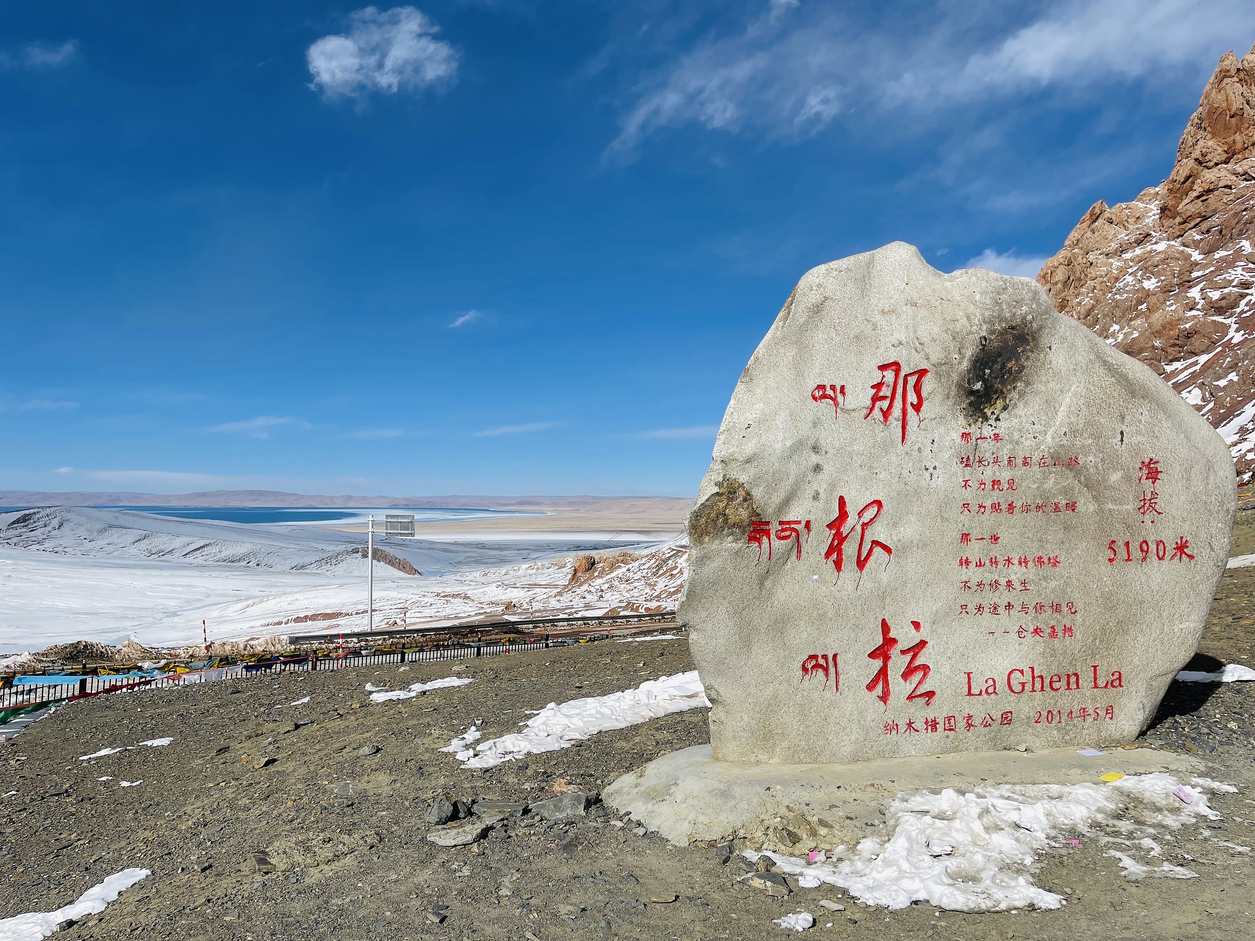
Nagenla Pass, located in Damxung County, Tibet, is the only place to go to Namtso. Nagenla Pass, in the Nyainqentanglha Mountains, with an altitude of 5,190 meters, a stone tablet indicating the altitude was erected at the pass, and prayer flags were hung on the Mani pile, because in the hearts of Tibetans, every pass is a sacred place , the hanging prayer flags represent the reverence for the gods. The temperature at Nagenla Pass is particularly low. Friends who travel to Namtso should bring their own down jackets, and masks are also necessary. Standing on the mountain pass and looking to the north, you can overlook the beautiful Nam Co.
-
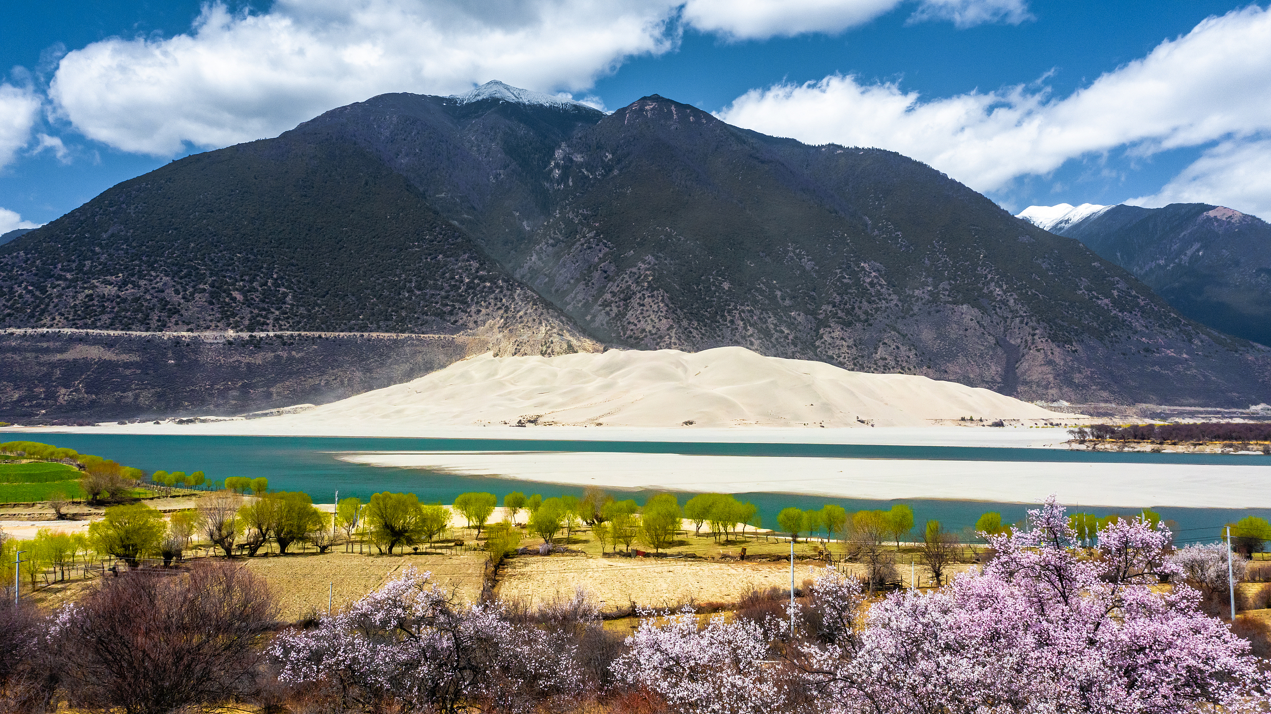
Buddha Palm Dune
The Buddha Palm Sand Dune is located on the north bank of the Yarlung Zangbo River in Daniang Township, Milin County. And viewing the dunes is free, the viewing platform is on the side of the road, and there are public toilets, so most tourists will get out of the car to see when they pass by.
-
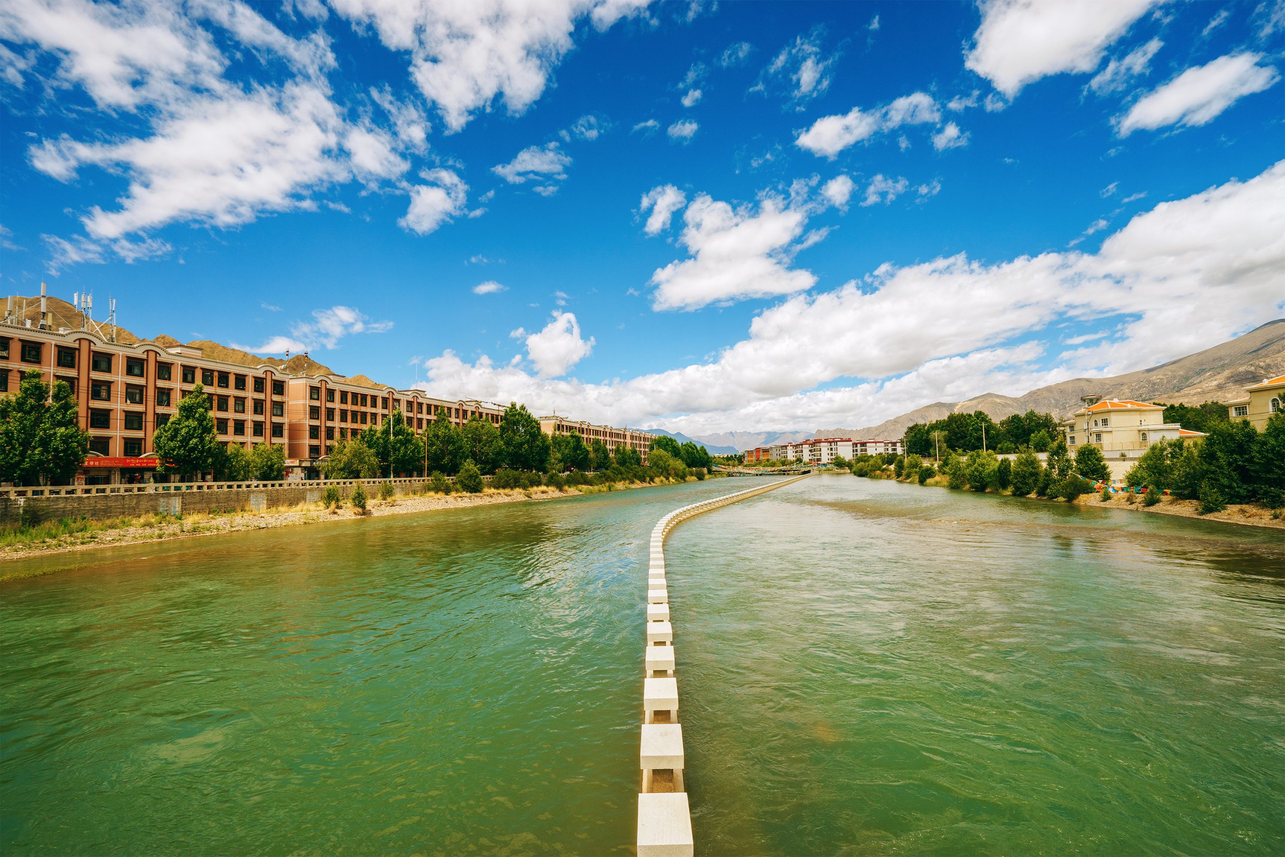
Lhasa River
The Lhasa River, called Jiqu in Tibetan, originates from the southern foot of the Nyainqentanglha Mountain, flows southwest through Lhasa City, and then joins the Brahmaputra River in Qushui County. The lower river valley is relatively open and is the main farming area in Tibet. Lhasa River is the mother river of Lhasa City and has a great influence on the development of Lhasa. In 633 AD, after the Tubo monarch Songtsan Gampo unified the Tibetan tribes, he moved the capital to the Lhasa River Valley, and the Lhasa River Basin developed along with it, gradually becoming the central area of economy, culture, transportation and religion in the Tibetan Plateau. The Lhasa River Basin is about 551 kilometers long from east to west, with a drainage area of 32,471 square kilometers. It is the largest tributary of the Yarlung Zangbo River Basin. The climate here is mild, the terrain is flat, the soil is thick, the water source is abundant, and the soil quality is good. The basin is rich in plateau animals, plants and geothermal resources, making it one of the main grain producing areas in Tibet. You may not be able to spend so long with the Lhasa River like the locals, but in the evening, you can take a walk by the river near Xianzu Island and Tibet University, and enjoy the beauty of the sunset touching the horizon. What’s even better is that there are many restaurants nearby, so you don’t have to worry about food and clothing at all.
-
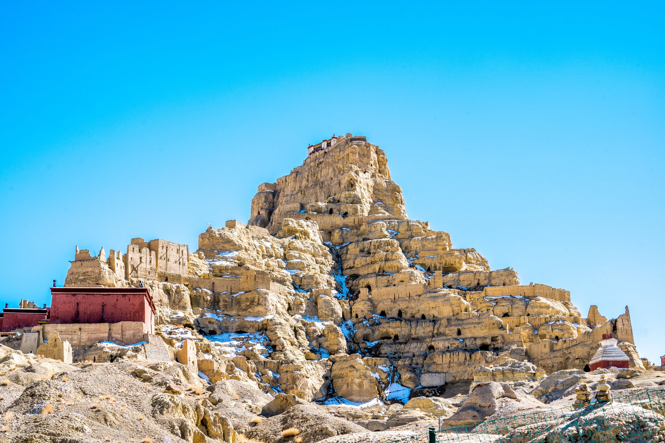
Ancient Guge Kingdom Site
The ruins of the Guge Kingdom are located on a loess slope about 300 meters high, 2 kilometers away from Zabrang Village in Zhada County. Houses, pagodas and caves are densely distributed all over the mountain, forming a huge ancient building complex. The ruins are divided into three levels: upper, middle and lower, which are the royal palace, temples and houses respectively.The Guge Kingdom was established in the first half of the 10th century AD, and had 16 hereditary kings. Its palace castle was also continuously expanded from the 10th century and reached its peak, ending in the 17th century when the Tubo Dynasty collapsed. The ruins are surrounded by city walls, with watchtowers at the four corners, and full of buildings and caves of the same color as the earth. They are large in scale, rigorous in layout, and majestic in appearance.From the entrance at the foot of the mountain, follow the path up the mountain. There are several well-preserved temple buildings halfway up the mountain, namely the Red Hall, the White Hall and the Tara Hall. The walls of the hall are covered with exquisite murals, with a rough style and heavy colors. Despite the years, the colors are still bright. These murals that record the lineage of the Guge kings and reflect the political, economic activities and cultural customs of the Guge region are very rare in China and have great ornamental and archaeological value. However, the doors of these halls are usually locked and require a Guide to open the door. There are more than a dozen caves around the temple, which also hide ancient weapons such as shields, armor, and swords.There is a secret passage connecting the mountainside, and you can directly reach the palace on the top of the mountain along the secret passage. There is a relatively well-preserved building in the palace, which is said to be the meeting hall of the Guge Dynasty. The main part of the murals in the hall is mostly Tantric Buddhist men and women practicing Buddhism together, with a bold style and strong colors. The lower part of the murals vividly shows the suffering of hell, and various types of punishment are horrible. The border is a long row of dozens of naked dakinis, charming and elegant, with various manners, and no one is the same.Walk out of the gate of the ruins, go south for about a few hundred meters, and go around the path on the edge of the cliff. There is a cave about 2 meters above the ground. This is the mysterious corpse cave in the Guge ruins. There are caves in the cave, divided into three cave halls. The cave is full of rotten bones. It is said that they are Guge soldiers and monks who were massacred by Ladakh. The strange thing is that the bones in the cave are all headless. The reason is still a mystery. There are several wooden ladders spliced together at the entrance of the cave. You can climb up to take a peek at the scenery inside the cave. However, due to the dry climate, the corpses are not completely decayed, and they emit a strange smell mixed with ghee. Those who are not immune should be cautious.The tour of Guge Ruins takes about 2 hours, after which you can take a bus back to Zhada County for food and lodging. If you want to take photos of the Guge Ruins at sunset, you can stay in Zhabu Rang Village, about 2 kilometers away from the Guge Ruins. There are currently family hotels in the village that can provide food and lodging, but reservations must be made in advance during the peak season.
-
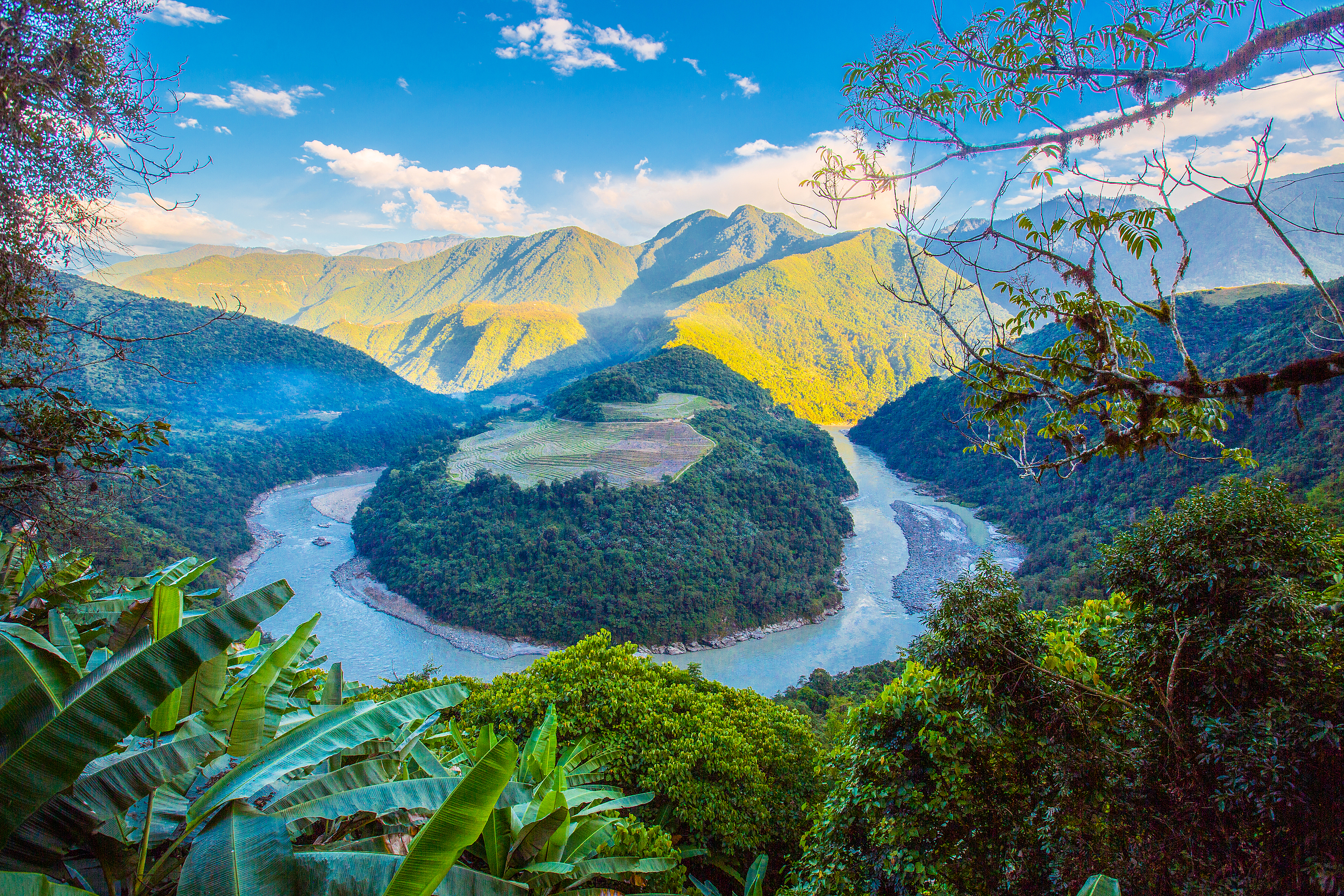
Guoguotang Big Turn
The Brahmaputra River makes a big bend in Guoguotang, which is also called Snake Bend locally. Guoguotang Big Bend is named Guoguotang because it looks like a lollipop.
-
Mi Dui Glacier
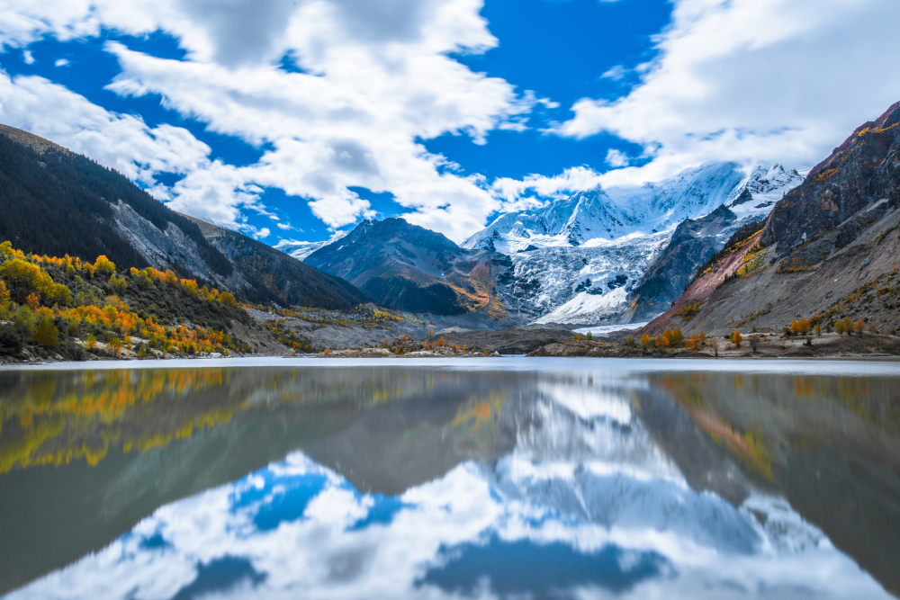
Midui Glacier is located near Mimei and Midui villages in Yupu Township, Bomi County, Nyingchi Prefecture. It is only 8 kilometers away from National Highway 318. It is very convenient to arrive. Due to the low altitude of the ice tongue, it can be easily viewed at close range. The Midui Glacier has a handsome shape and was rated as one of the six most beautiful glaciers by China National Geographic. To watch the Midui Glacier, you must first reach Midui Village at your feet. The ticket office is about 6-7 kilometers away from Midui Village. This section of the road has poor road conditions. From Midui Village to the viewing platform, you can walk, but the distance is longer, about 2.5 kilometers, and it takes about 45 minutes. You can also ride horses, and you need to pay about 100 yuan for the round trip. After reaching the viewing platform, you can see the open glacier unfolding in front of you, which is very spectacular.
-
Nanyigou Scenic Area
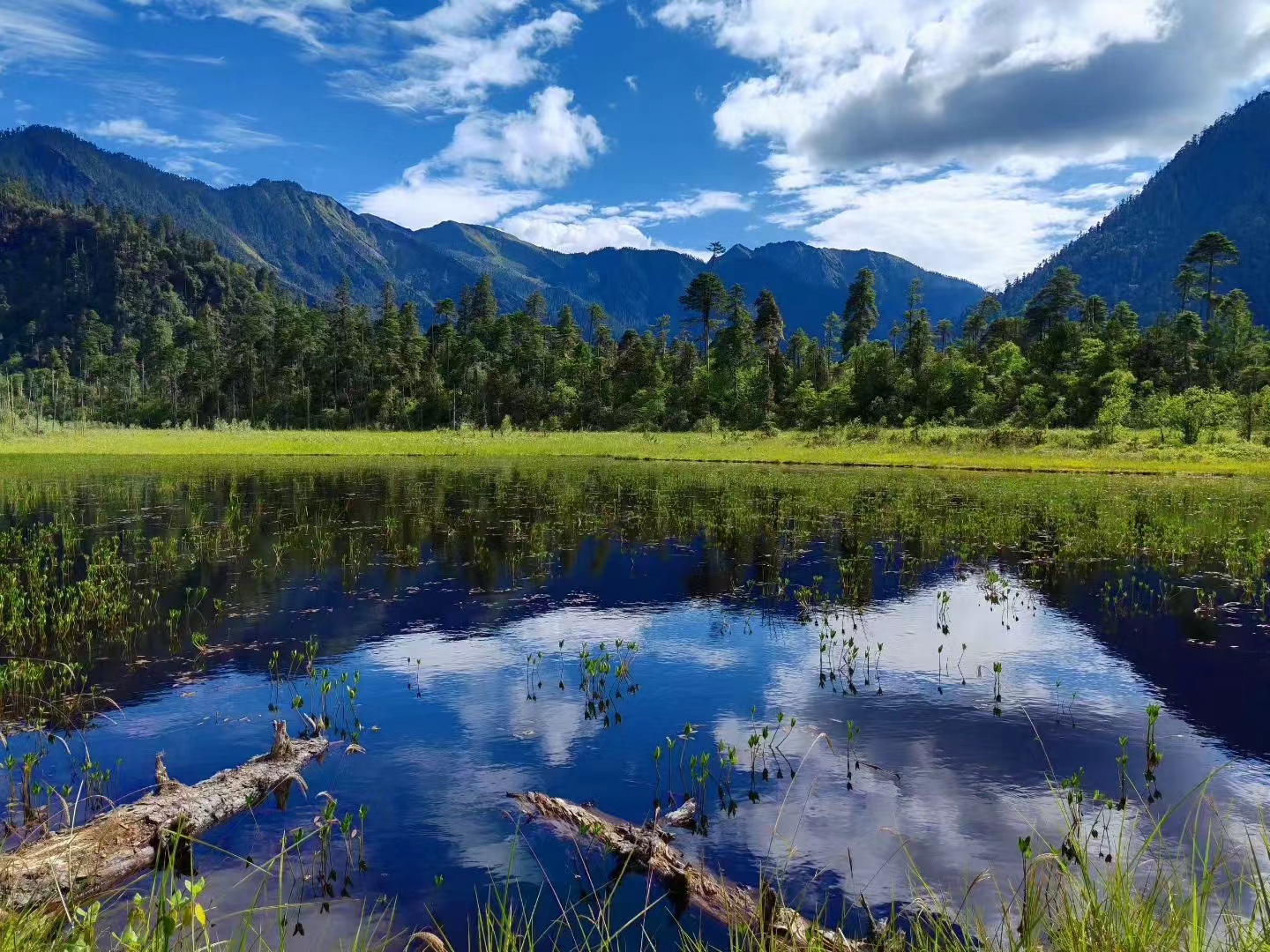
The Nanyigou Valley is located in Milin County’s Nanyigou Township. It is also known as the Valley of the Medicine King. It is a quiet and beautiful canyon. This location has much well-preserved natural virgin forest in the surrounding mountains. It is a green paradise hidden away from the outside world. Within this area, visitors can also go to the Minba Folk Village to experience unique Lhoba culture, taste their foods and discover their ethnic costume.