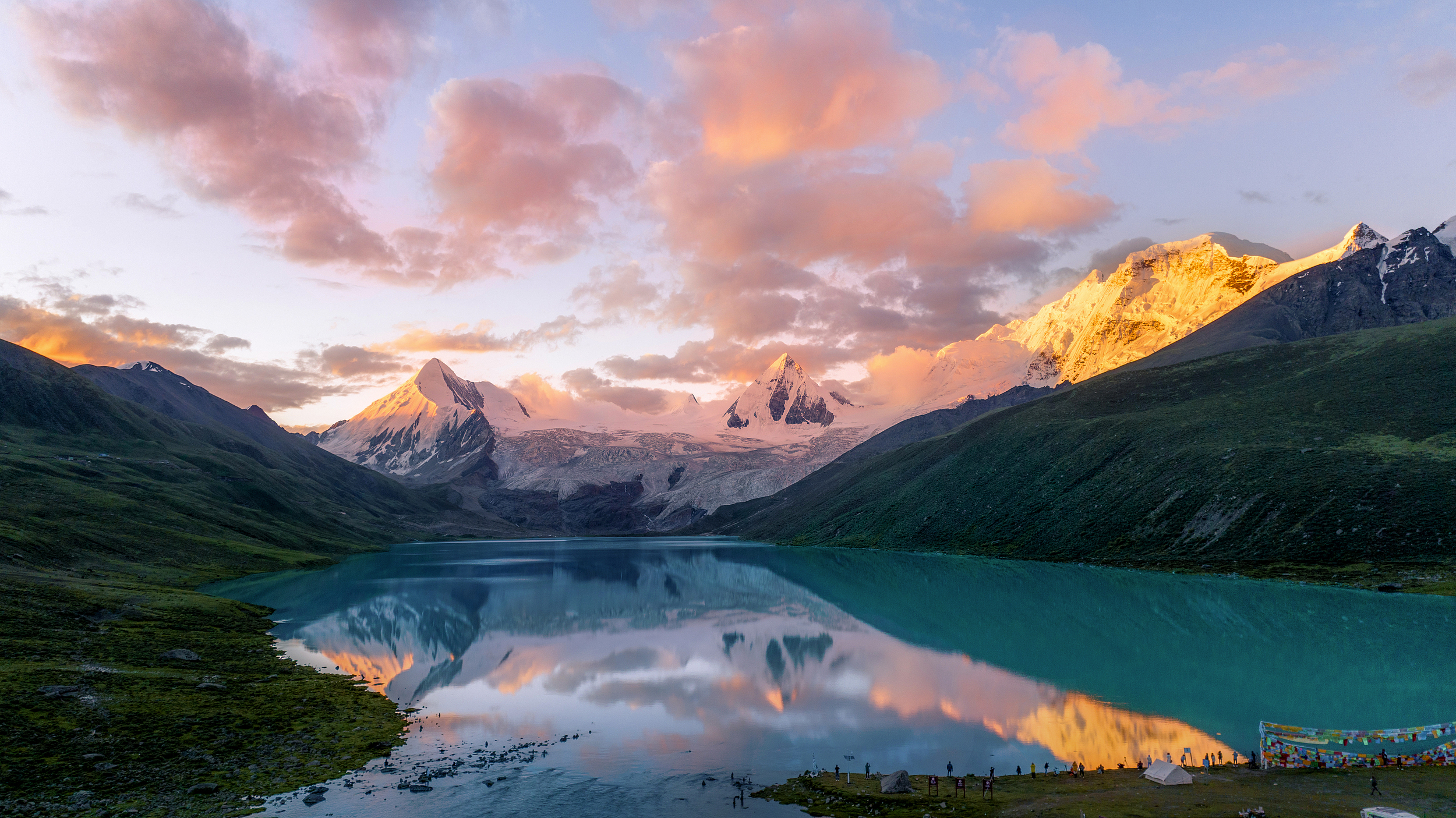
Sapu Sacred Mountain is located in Puzonggou, Yangxiu Township, Ruxian County. It has been standing here for thousands of years. It is one of the sacred mountains of Bon religion in Tibetan Buddhism. The Sap Sacred Lake is formed by the melting of ice and snow on the mountain for thousands of years. It extends from the foot of the mountain and is divided into two parts. It is close to the glacial lake at the foot of the mountain and does not melt all year round. The other part is the main lake. The water is clear and clean. Every year, a grand lake-turning and blessing event is held near the Sap Lake. In midsummer, the top of Sapu is covered with snow and snow, surrounded by rain and fog, and the bottom of the mountain is red and green, and the water and grass are lush. Due to the deep valley and inconvenient transportation, this breathtaking glacier has always been hidden in the boudoir and little-known, and it better retains its original atmosphere.
归档: Attractions
-
Dra Shi Monastery
Zaki Temple is located on Zaki Road in the northern suburb of Lhasa. It is the only temple of wealth in Tibet. Although the temple is small, the incense is very prosperous. The temple is the deity of the Auspicious Heavenly Mother-Zakiram Buddha Hall, with strong incense, monks with cultivation bases anointing the guests with blessings and precious gifts. Dharma protectors in the world still have a relationship with all living beings, so many times they will transform into human figures and come into contact with all living beings. Goddess Zaki belongs to such gods and is particularly effective. Many Tibetans and Han people come here every Wednesday to worship Buddha. The main god of Zaki Temple is addicted to alcohol, so people who come to Zaki Temple to worship will not only bring Hada and Sangzhi, but also white wine or highland barley wine.
-
Lu Lang Forest
Lulang Forest is located in Lulang Town, the north of Bayi Town. There is an immense forest here, and the species of trees mainly include picea asperata and pinewood. The landscape is fresh and picturesque. It is also an ideal place for grand shoots. Lulang Forest covers a vast area. Visitors can enter the scenic area or the viewing platform on National Highway 318 for observation and shooting. When you pass by Lulang Town by driving on National Highway 318, you can enjoy an immense forest even without walking into the view platform.
-
Yaowang Mountain
Chakpori, known as the Tibetan name for the mountain’s corner, is one of the four sacred mountains of Tibet, with an altitude of 3725 meters.Chakpori is roughly S-shaped, with two peaks, east and west. On the mountain is the Chala Lupu Monastery, the residence of early Tibetan medical lamas. In the late 17th century, Desi Sangye Gyatso built the Menba Zhacang (medical college) here, making it an important center for the development of Tibetan medicine. Legend has it that this is where Princess Wencheng prayed eastward when she missed her hometown, adding to its sacred atmosphere. The Thousand Buddha Cliff on the west side is one of the oldest cliff carvings in Tibet, with over 5000 Buddha statues of various forms carved on nearly two kilometers of cliff face. Chakpori is also one of the best locations for photographing the Potala Palace; the viewing platform halfway up the mountain is the spot featured on the 50 RMB banknote. Every year, numerous pilgrims and photography enthusiasts come to experience its unique religious atmosphere and magnificent scenery.
-
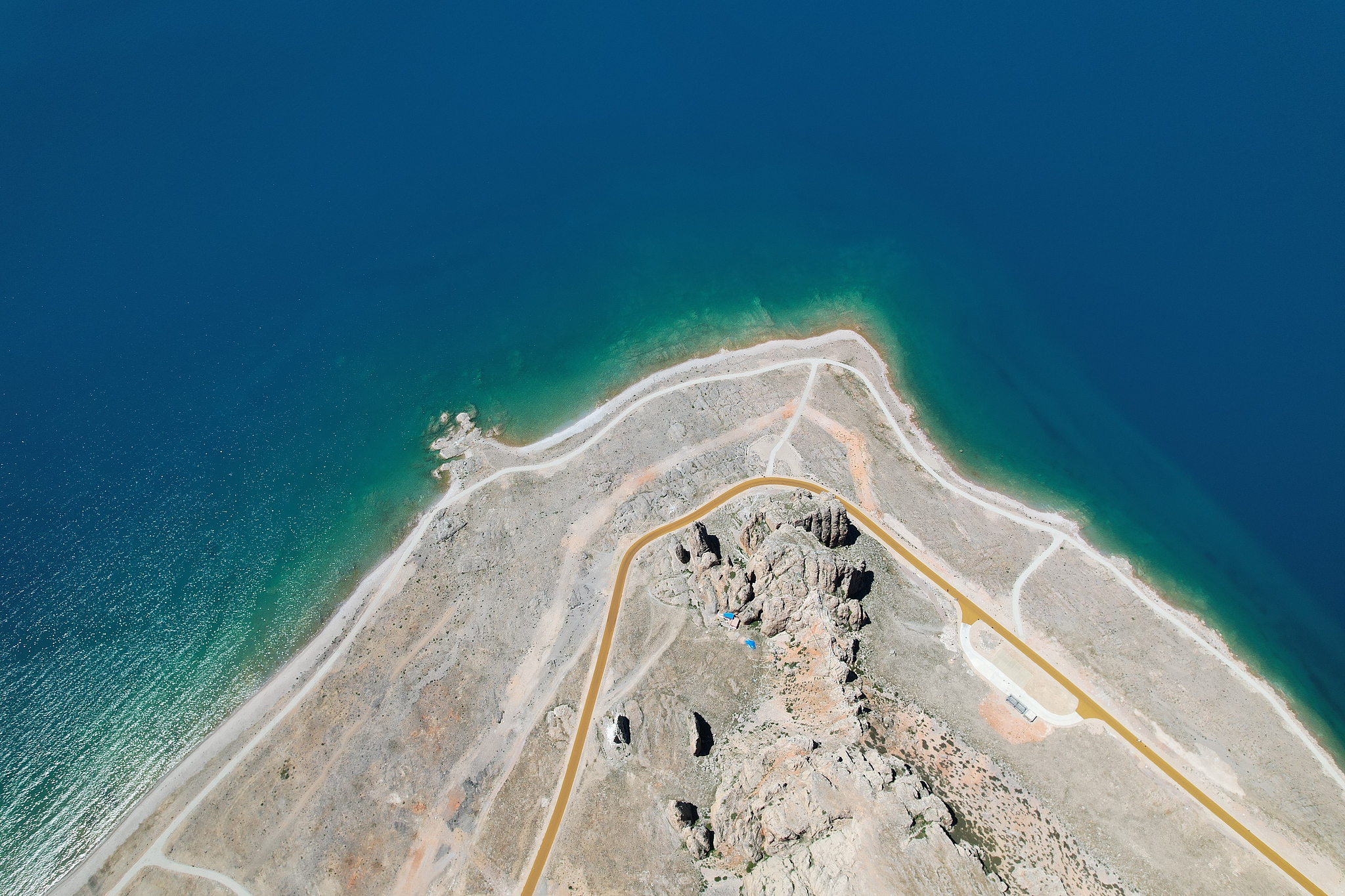
Namtso Tashi Peninsula
The Zhaxi Peninsula, also known as the Auspicious Love Island, is located in Dangxiong County, Xizang. It is the largest peninsula in Namtso and an important tourist attraction for visiting Namtso. The Zhaxi Peninsula is located at the southeast end of Namtso Lake and extends northward into the lake. It is a peninsula of about 10 square kilometers made of limestone. In the middle is a small hill several dozen meters high. At the north end, there are countless stone pillars and strange stone peaks. There are also natural stone bridges connecting the peaks. Because it has been eroded by the water of the lake for a long time, there are many quiet caves on the island, which are full of stalactites, forming a unique karst landform. Such a strange and colorful landform on Zhaxi Island is a wonder. Zhaxi Peninsula is the most concentrated place for religious activities in Namtso. There is Zhaxi Temple on the peninsula (Zhaxi means auspicious in Tibetan), which is still filled with incense and morning bells. There is a large cave beside the circumambulation road of the peninsula, called the Lotus Cave. It is said that there is a naturally formed Lotus Pagoda in the cave. Along the circumambulation path of the peninsula to the lake, the first thing you see is the welcoming stone on the roadside. Countless banners as long as the welcoming stone of the Zhaxi Peninsula float down from the top of the mountain, decorating the huge stone with colorful colors. The welcoming stone is two pieces of dissolved stone, also known as the husband and wife stone, and is the door god of Namtso.
-
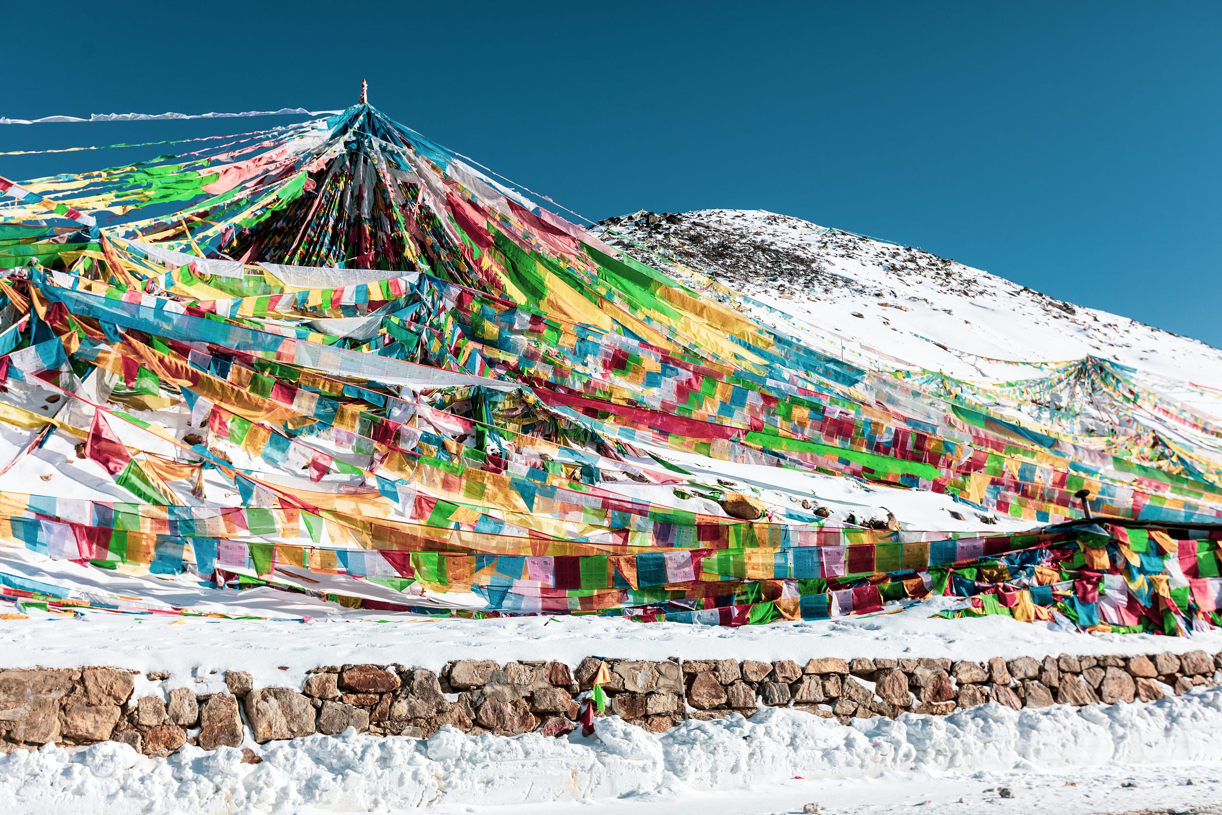
Sejila Mountain
Sejila Mountain is located on the southeast side of Bayi Town. When walking on the Sichuan-Tibet line, Bomi will pass by on the Bayi Road. It is a famous landmark on the Sichuan-Tibet line. The Sejila Mountain Pass is 4,728 meters above sea level, with a wide field of vision. You can overlook the Lulang Forest Sea and the Nanga Bawa Peak behind it. It is a good place to take pictures. The rhododendrons all over the mountains are also a famous landscape of Sejila Mountain. From April to June every year, from the foot of the mountain to the mountainside, as many as two dozen kinds of rhododendrons gradually bloom in the mountains, with various colors and shapes, bright and dazzling. Combined with the colorful prayer flags flying in the mountain pass, the scenery is gorgeous. When tourists pass by, they will inevitably stop and watch.
-
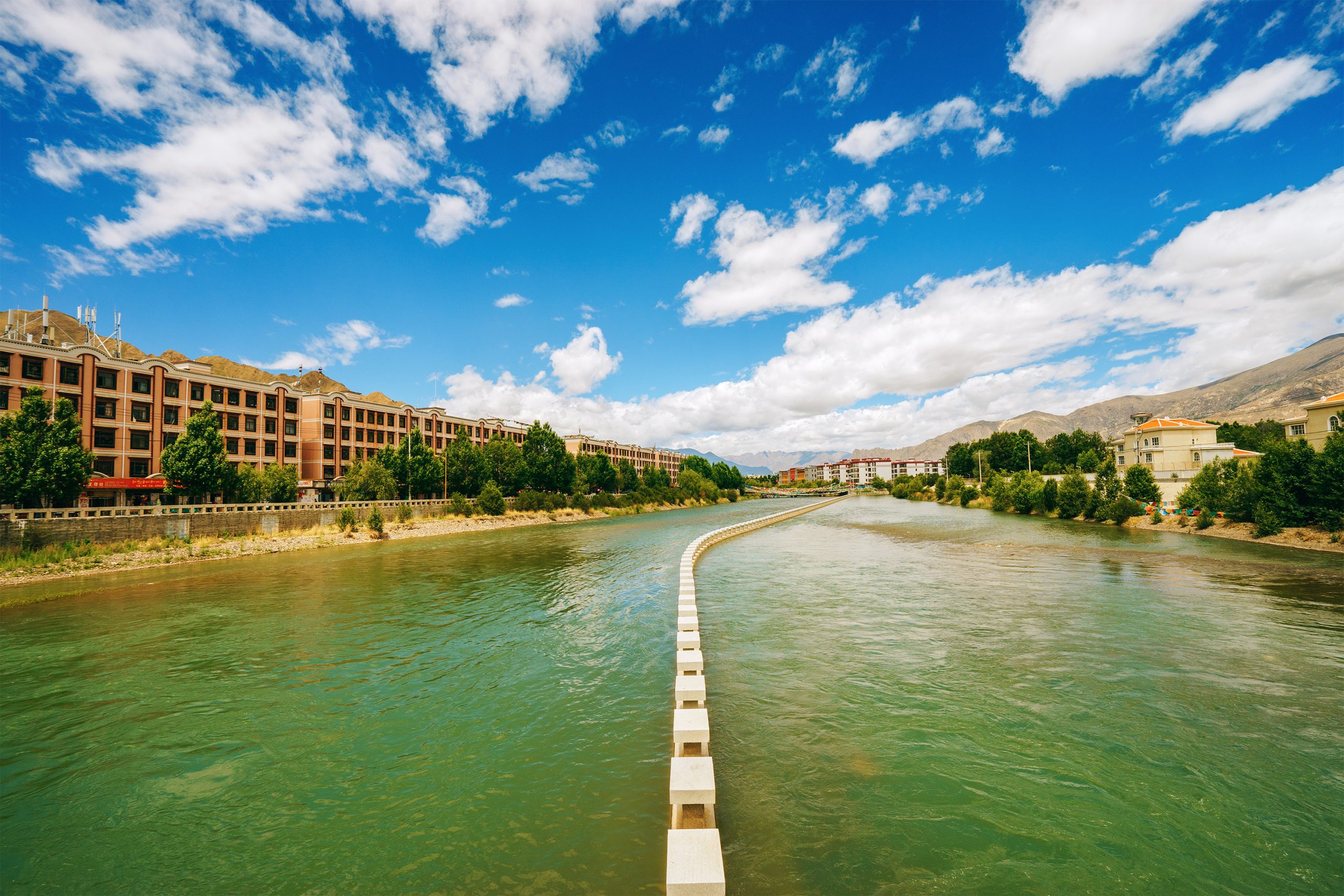
Lhasa River
The Lhasa River, called Jiqu in Tibetan, originates from the southern foot of the Nyainqentanglha Mountain, flows southwest through Lhasa City, and then joins the Brahmaputra River in Qushui County. The lower river valley is relatively open and is the main farming area in Tibet. Lhasa River is the mother river of Lhasa City and has a great influence on the development of Lhasa. In 633 AD, after the Tubo monarch Songtsan Gampo unified the Tibetan tribes, he moved the capital to the Lhasa River Valley, and the Lhasa River Basin developed along with it, gradually becoming the central area of economy, culture, transportation and religion in the Tibetan Plateau. The Lhasa River Basin is about 551 kilometers long from east to west, with a drainage area of 32,471 square kilometers. It is the largest tributary of the Yarlung Zangbo River Basin. The climate here is mild, the terrain is flat, the soil is thick, the water source is abundant, and the soil quality is good. The basin is rich in plateau animals, plants and geothermal resources, making it one of the main grain producing areas in Tibet. You may not be able to spend so long with the Lhasa River like the locals, but in the evening, you can take a walk by the river near Xianzu Island and Tibet University, and enjoy the beauty of the sunset touching the horizon. What’s even better is that there are many restaurants nearby, so you don’t have to worry about food and clothing at all.
-
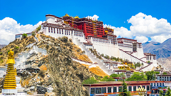
Potala Palace
The Potala Palace is the symbol of Xizang and a sacred place in the hearts of all pilgrims! “Potala” is a Sanskrit word, also translated as “Putuo”, which originally refers to the residence of Guanyin Bodhisattva. When you come here, you can not only view the large number of historical relics collected in the palace, appreciate the wonderful architectural art of the Tibetan people, but also have a baptism of the soul in that holy atmosphere. The origin of the Potala Palace According to historical records: In the 1930s of the seventh century AD, the 33rd Tibetan King Songtsen Gampo moved the capital to Lhasa and began to build the Potala Palace. Since then, major religious and political ceremonies have been held here, and it has become the ruling center of Xizang integration of politics and religion. The White Palace and the Red Palace The Potala Palace has a distinct Tibetan style and is majestic. It is the existing complete palace-style building complex in Xizang and is known as one of the world’s top ten earth buildings. Its main buildings are divided into two parts: the White Palace and the Red Palace. The White Palace is named after its white exterior wall. It is the place where the lamas live and conduct political activities. Because the sun shines all day long, it is called the East and West Sunlight Palaces. The Red Palace is located at the top center of the Potala Palace. Its outer wall is red and it consists of many stupas and various Buddhist temples. Historical relics The Potala Palace houses and preserves a large number of historical relics, including stupas, statues, murals, thangkas, scriptures and books, as well as gold books, jade books, gold seals granted by the emperors of the Ming and Qing dynasties, which show the historical relationship between the Xizang local government and the central government, as well as gold and silver wares, jade wares, porcelain, enamel and handicrafts. Among them, the eight stupas from the fifth generation are eye-catching. They are all magnificent and decorated with a dazzling array of gems, which can be called a palace of art.
-
Namtso
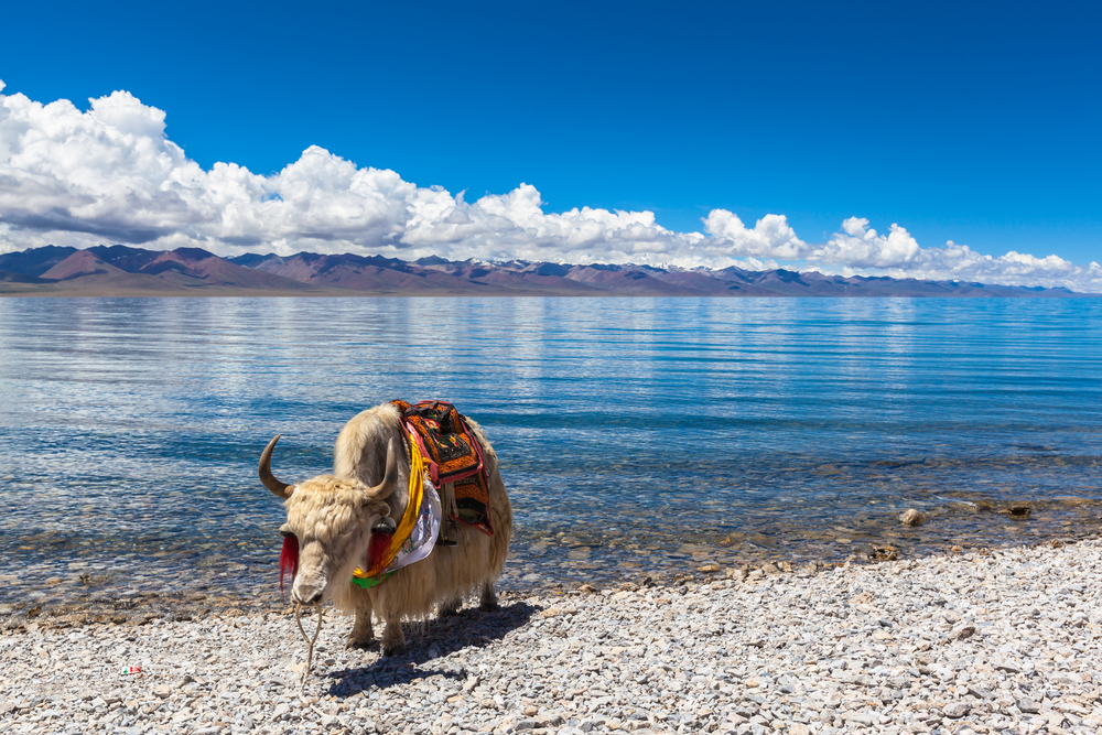
Namtso is 240 kilometers from Lhasa. It is one of the three largest holy lakes in Tibet and is also a famous holy site for Tibetan Buddhism. The endless snow-capped mountain beside the lake is the Nyainqentanglha Mountain. On a beautiful day, the snow-capped mountains are reflected in the lake, giving a sense of peace and tranquility. There are numerous secular believers who come to Namtso every year on April 15 of the Tibetan calendar to celebrate the Saga Dawa Festival.
-
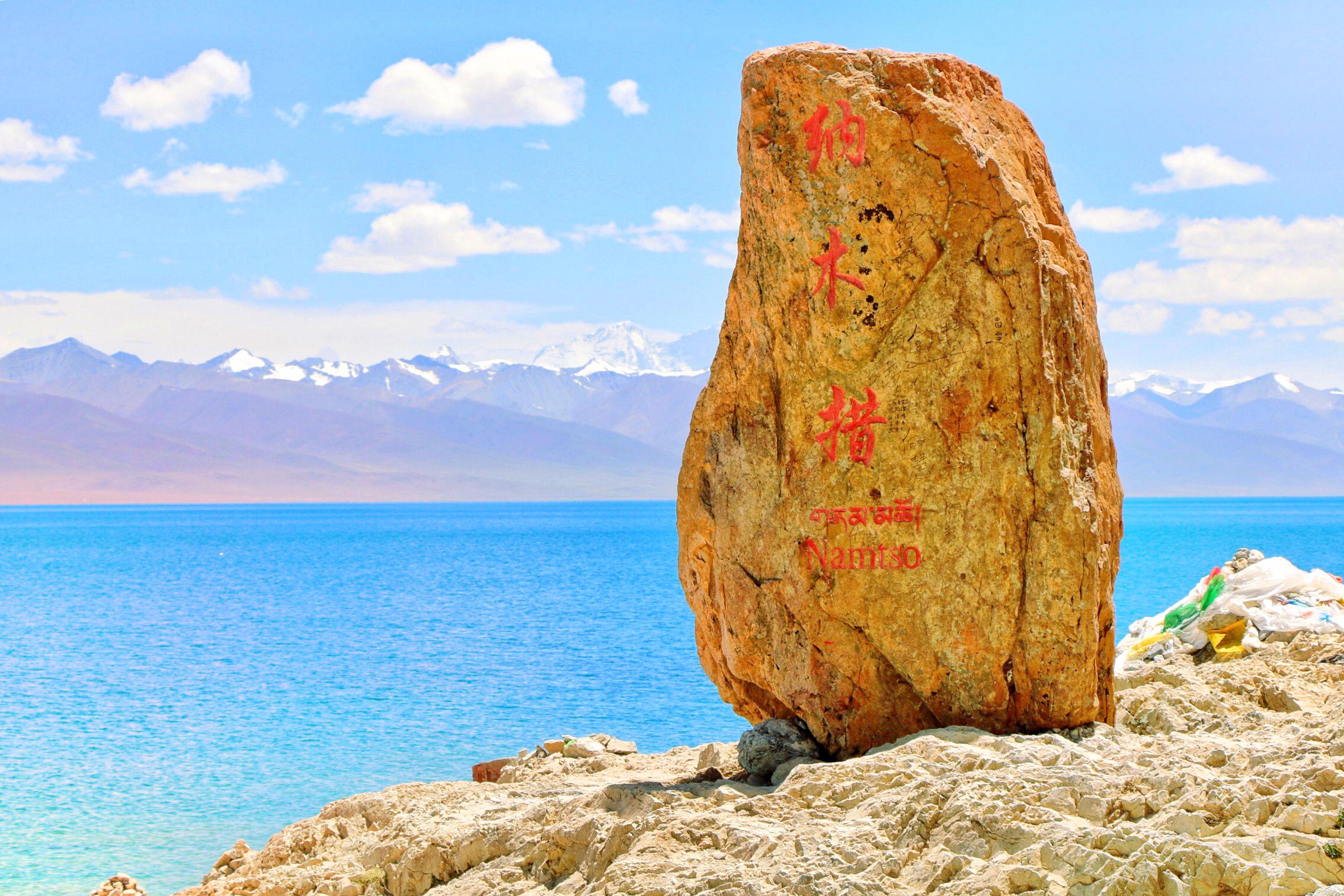
Namtso National Park
Namtso National Park is located between Damxung County of Lhasa City and Bange County of Nagqu Prefecture, on the Qinghai-Tibet Plateau known as the “roof of the world”. Scenic spots include Nian Namtso, the main peak of Nyainqentanglha Mountain, Lake Bird Island, petroglyphs and stone carvings, Yangbajing and other scenic spots. Namtso, the core scenic spot of the park, is one of the three holy lakes and the highest saltwater lake in the world. Under the sunlight, the lake surface of Namtso is azure blue, like emeralds falling from the sky. It is known as the “Heavenly Lake” and is a famous pilgrimage site for Tibetan Buddhism. There are three larger islands in the lake. These islands are rarely disturbed by the outside world, and there are many birds inhabiting them. They are called Bird Island. To the south of Namtso lies Nyainqentanglha Mountain, which is covered with snow all the year round, and to the north and west there are plateau hills and a vast lakeside. In the folk songs and legends of local shepherds and hunters, Nyainqentanglha and Namtso are not only eye-catching sacred mountains and holy lakes, but also lovers and couples who depend on life and death. Nyainqentanglha Mountain looks more handsome and upright because of the background of Namtso, and Namtso is more beautiful and moving because of the reflection of Nyainqentanglha Mountain.