The Yani Wetland Attraction in the Benri Attraction (formerly the Benri Sacred Mountain) is a sacred mountain of the native Bon religion in Xizang. It stands on the southeast side of Bayi Town and consists of a group of peaks of similar height. The top of the mountain is shrouded in clouds and mist all year round. The mountainside is covered with dense forests and flowers in full bloom, which change with the seasons. The founder of the Bon religion, Xinraomiwo, is enshrined in the ancient temple in the forest.Bonri Mountain is a sacred mountain of the Bon religion. Believers come here to circumambulate the mountain and worship it all year round. The ancient Bon temple in the mountain holds a large-scale event every 12 years, called the Niangbulasu Festival. Its scale is huge, with many believers and believers, and it lasts for a long time, which is rare in the whole region.
归档: Attractions
-
Shiquan River
Shiquan River, also known as Senge Zangbo, has wide valleys along its banks, with swamps and hot springs. Most of the hot springs are groundwater that gushes out from the cracks in igneous rocks. They not only replenish the river, but also increase the temperature of the river water, making some river sections rarely freeze in winter. Because it is located in an arid area, the Shiquan River system is not well developed, with an average runoff depth of only 25 mm and an annual runoff of about 700 million cubic meters. Despite this, it is still a valuable water source in the hinterland of the plateau with a dry climate and scarce fresh water.
-
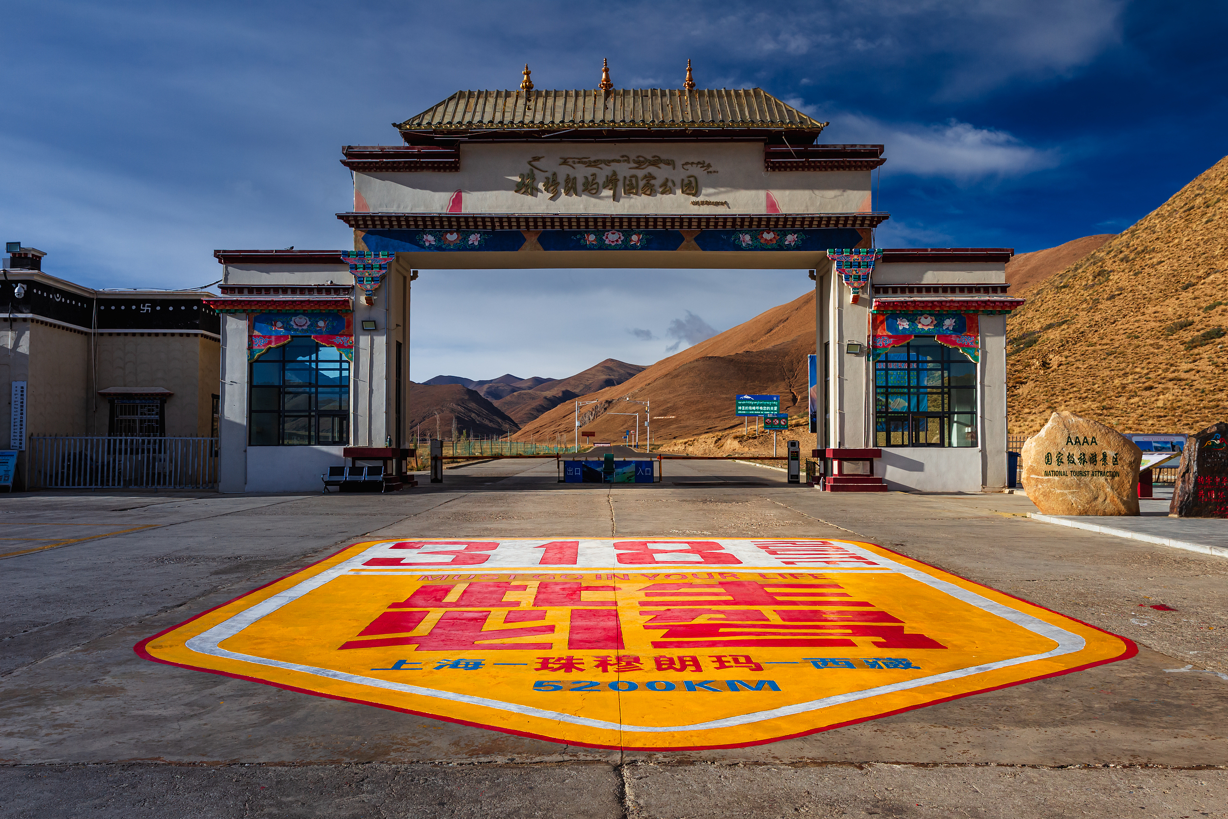
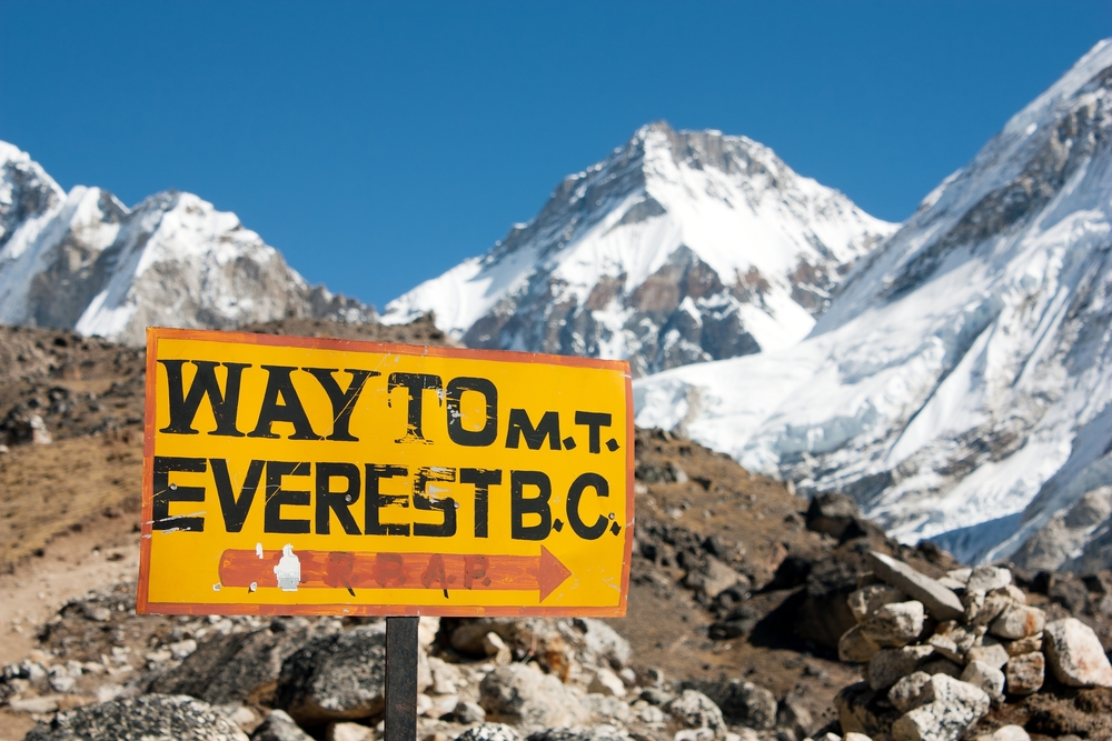
Mt.Qomolangma National Park
Mt. Qomolangma National Park, located in Tingri County, Xigaze City, Xizang Autonomous Region of China, is home to the world’s highest peak. The park features major attractions such as the Mt. Qomolangma Base Camp, Rongbuk Monastery, and the Mt. Qomolangma Viewing Platform, making it a top destination for mountaineers and visitors alike. As the pinnacle of the world, Mt. Qomolangma captivates countless adventurers not only with its majestic height but also with its mystique and challenge.The Everest Base Camp, located at an altitude of 5,200 meters within Mt. Qomolangma National Park, is one of the ideal spots to admire the majestic peak. Visitors can witness the breathtaking grandeur and serene beauty of Mount Everest up close. The viewing platform offers a perfect vantage point, especially during sunrise and sunset when the mountain glows under the sunlight, making it a paradise for photography enthusiasts. The surrounding glaciers, snowfields, and alpine lakes create a stunning natural panorama.Rongbuk Monastery, located near Mt. Qomolangma Base Camp, is a historic Tibetan Buddhist temple where visitors can experience the atmosphere of religious culture. Mt. Qomolangma National Park is not only a sightseeing destination for exploring nature and challenging oneself, but also a place for spiritual purification.
-
Mt Qomolangma National Park
Located in the heart of the Himalayas, Everest National Park attracts not only climbers and explorers, but also nature lovers and cultural seekers. Rare animals such as snow leopards and Tibetan antelopes, as well as unique plateau plant communities, provide valuable resources for biodiversity research. In addition, the park is rich in cultural heritage, and Tibetan culture and Buddhist temples add a mysterious touch to this land. The park is also rich in cultural heritage, and Tibetan culture and Buddhist temples add a mysterious touch to this land. In Mount Everest National Park, visitors can feel the charm of harmonious coexistence between man and nature, and also experience the endless fun of challenging the limits and conquering nature. Whether it is hiking or cultural exploration, this is a destination that cannot be missed, waiting for the arrival of every explorer.
-
Nam Co Sheng Xiang Tian Men
Nam Co Sheng Xiang Tian Men is located in Qinglong Township Village 5, Baingoin County, Nagqu Prefecture, on the Qiaduo Langka Island in the northern part of the holy lake Nam Co attraction. The entrance to the Nam Co Sheng Xiang Tian Men tourism town leads to the dry karst cave, Sansheng Stone, Couple Stone, and the Sheng Xiang Tian Men tourism view belt. The attraction covers an area of 59 square kilometers. The Nam Co Sheng Xiang Tian Men tourist attraction boasts a rich variety of resource types, with a large number of distinctive resource entities. Following the “Classification, Investigation, and Evaluation of Tourism Resources” (GB/T 18972-2003) and considering the distribution of tourism resources in the area, a comprehensive survey, exploration, organization, classification, and summary of tourism resources were conducted. In terms of resource types, the attraction encompasses all seven major categories outlined in the “Classification, Investigation, and Evaluation of Tourism Resources” (GB/T 18972-2003), covering all primary types and most subcategories and basic types under the national resource classification standard. These include: – 9 basic types of geological landscapes – 3 basic types of water scenery – 4 lake wetlands – 2 natural hot springs – 7 basic types of biological landscapes – 3 basic types of celestial and climatic phenomena – 3 basic types of historical relics – 3 basic types of architectural and facility resources – 4 basic types of tourism commodities – 4 basic types of cultural activities The Nam Co Sheng Xiang Tian Men tourist attraction holds significant heritage value, scientific research value, and tourism experience value. The relic resources remain unaffected by industrialization, tourism development, or other human activities, preserving their original appearance and maintaining the integrity of the resource entities. Nam Co Sheng Xiang Tian Men combines diverse natural landscapes including plateau snow mountains, lakes and rivers, marsh meadows, and celestial phenomena with unique Tibetan nomadic culture, highland village views, and sacred Tantric Buddhist sites. ·Tianmen of the Sacred Elephant Legend has it that on the northern Qiaduo Langka Island of Nam Co Sheng Xiang Tian Men, there are many naturally formed Buddha images and inscriptions on the cliffs, which people have endowed with religious significance as sacred relics. When practitioners came to Qiaduo Langka Island, lacking houses or temples, they carved caves into the cliffs for long-term meditation. As more practitioners arrived, Qiaduo Monastery was built on the island, belonging to the Gelug school, now over 370 years old. During its peak, Qiaduo Monastery had over 500 monks chanting and practicing. In front of and behind Nam Co Sheng Xiang Tian Men stand two small independent reefs resembling fierce crocodiles, guarding the sacred site on either side. The unique “gateway” of Nam Co Sheng Xiang Tian Men offers distinctive views when looking through the heavenly gate.Nam Tso Lake and Nyenchen Tanglha Mountains stand side by side in perfect harmony. In the many caves on the northwest side, ancestors have left numerous historical rock paintings. These paintings date back to ancient times, featuring rich content where themes of nature and religion intertwine, encompassing profound Tibetan cultural significance. As early as 1996, the People’s Government of Xizang Autonomous Region and the People’s Government of Baingoin County designated this area as an autonomous region-level cultural relic protection site. Crescent Bay At the mountaintop beside Nam Co Sheng Xiang Tian Men, overlooking the lake and its crescent-shaped shoreline, lies the Moon Bay – a classic photography spot for capturing reflections of the lake waters and snow-capped mountains. – Sansheng Stone The peninsula extending into the lake near Nam Co Sheng Xiang Tian Men is called the “Stone of Three Lives,” symbolizing the past, present, and future according to legend.
-

Barkhor Street
Barkhor Street, also known as Bajiao Street located in Lhasa, Tibet. The street is a well known ancient street representing the culture and folk customs of Tibet. While walking on the street, you can experience what life was like in the past, and experience the food and culture of natives to Lhasa. You can view and learn things from traditional dress, and dances, to traditional meals, to the architecture of the town itself, which has been well preserved throughout the years. Barkhor Street is a must-visit location to experience in Lhasa.
-
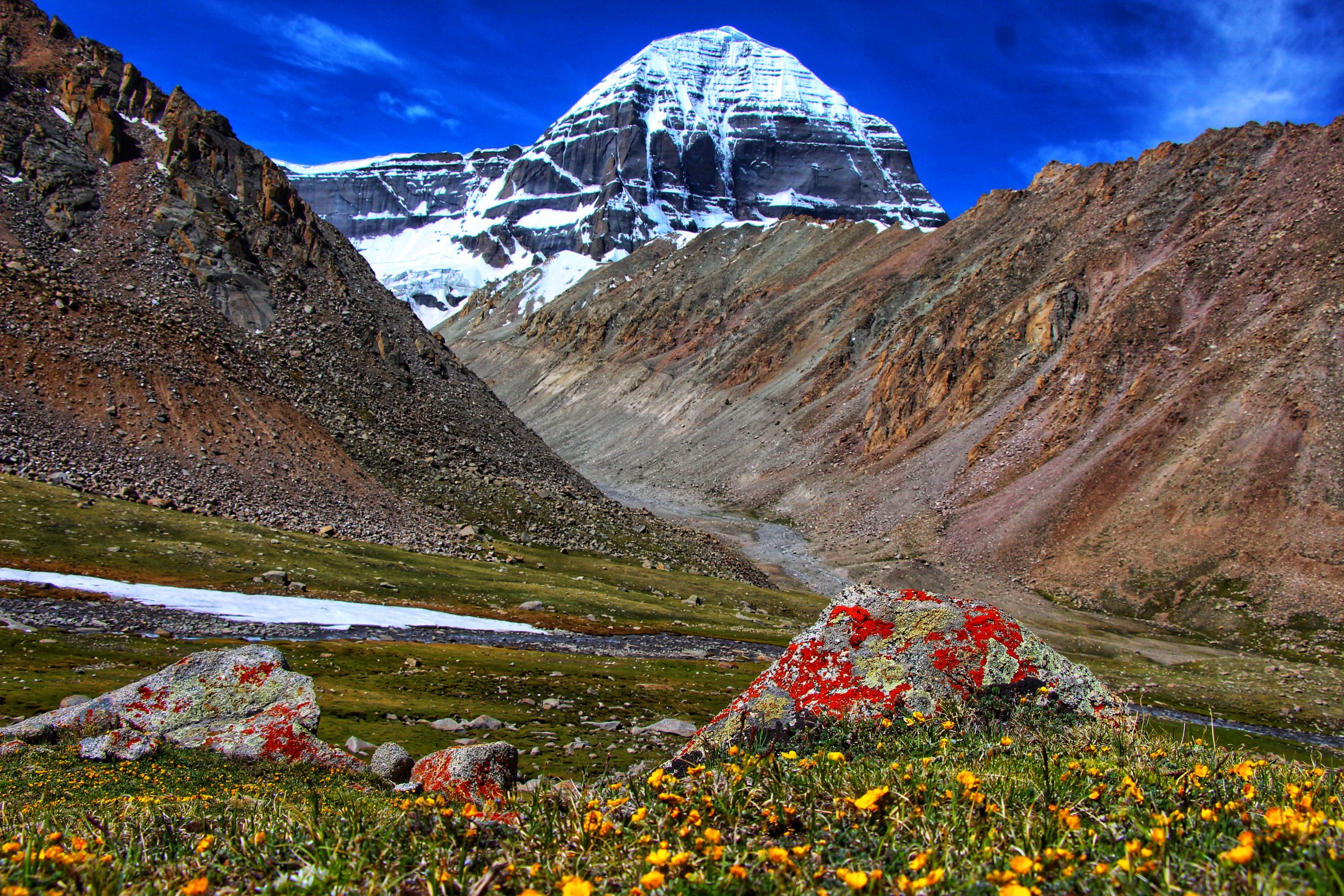
Kangrinpoche
KangrinpocheIt is the main peak of the Gangdise Mountains, located in Baga Township, northern Purang County, Ngari Prefecture, with an elevation of approx. 6,656m. Recognized globally as a sacred mountain, it is also considered the center of the world by many Buddhist traditions.
-
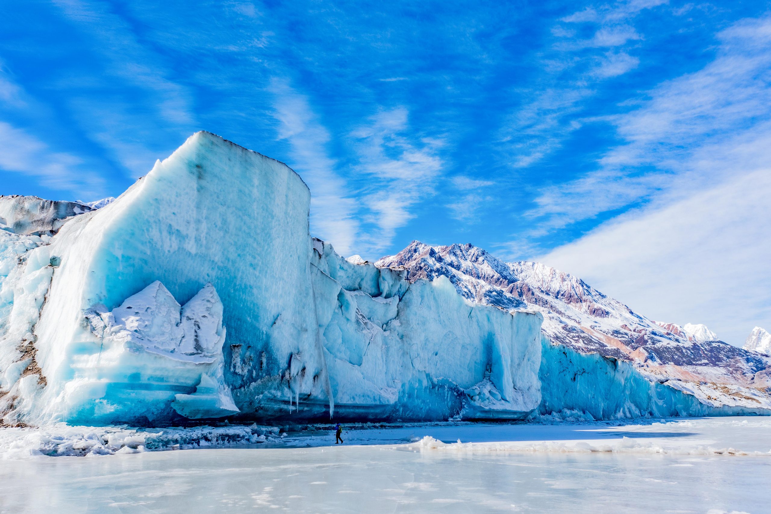
Laigu Glacier
Many glaciers surrounding Laigu Village have formed many ice lakes in front of the village. Due to the different geology and soil composition of different glaciers, each ice lake will reflect different colors. There is a large ice lake floating on the ice lake. Big and small icebergs. Between the end of the glacier and the glacial lake, the broken glacier reveals a layer of blue ice tens of meters high. In Laigu Village, you can see Meixi Glacier, Yalong Glacier, Ruojiao Glacier, Dongga Glacier, Xiongjia Glacier and Niuma Glacier. Because all these glaciers surround Laigu Village, they are collectively called Laigu Glaciers ( Note: Due to the changing seasons of glaciers, the viewing period of each glacier is different, and the scenery seen at different times is different.) Among them, the Yalong Glacier, which is 12 kilometers long at the eastern end of Gangrigabu Mountain, is more majestic. It is more than 6,000 meters above sea level. The main peak extends to the edge of Laigu Village at an altitude of about 4,000 meters. The simple village road along the Ranwu Lake, even if you have reached the ancient village, the Laigu Village with more than 70 households still maintains the original Tibetan village style of half farming and half pastoralism. The houses in the village are relatively scattered, subdivided into several smaller villages and settlements such as Shatuna, Lanage, Qu’e, and Ranmu. The distance between the villages is two to three kilometers, and there are fields between the small villages. ridge.
-
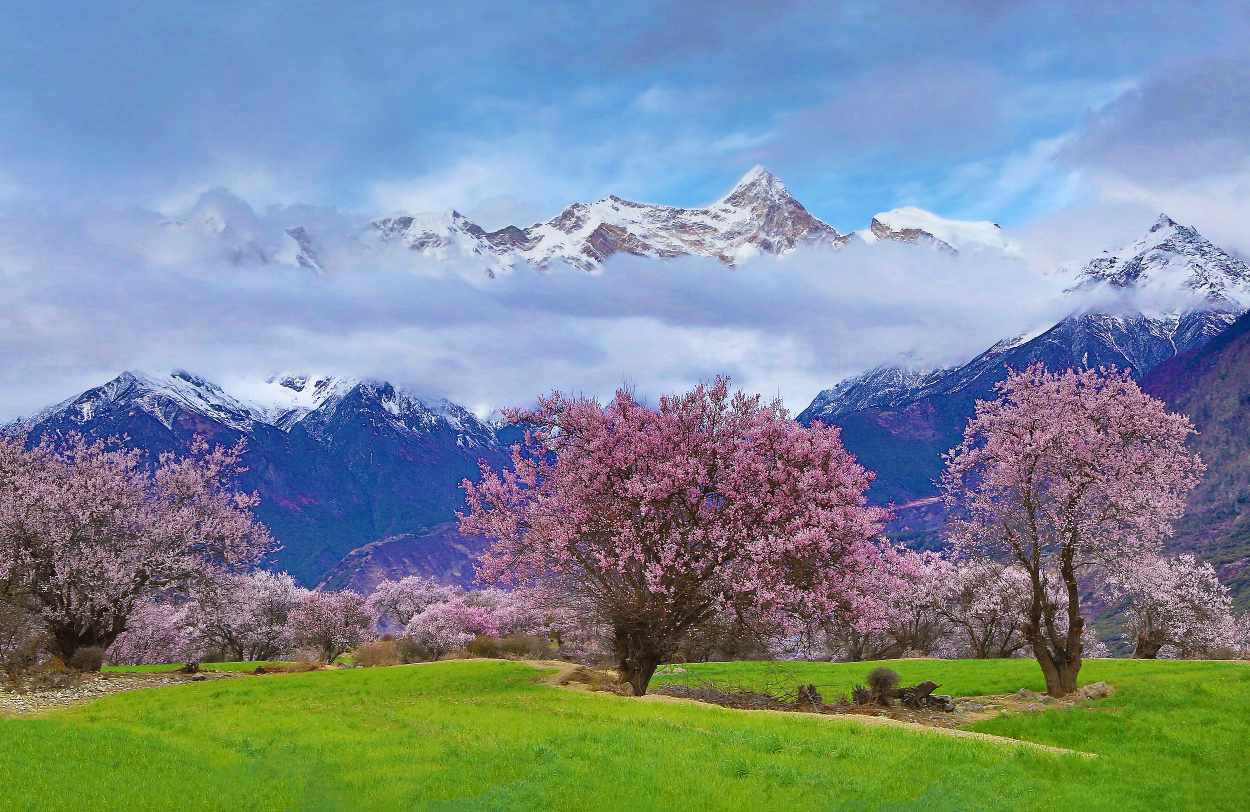
Suosong Village
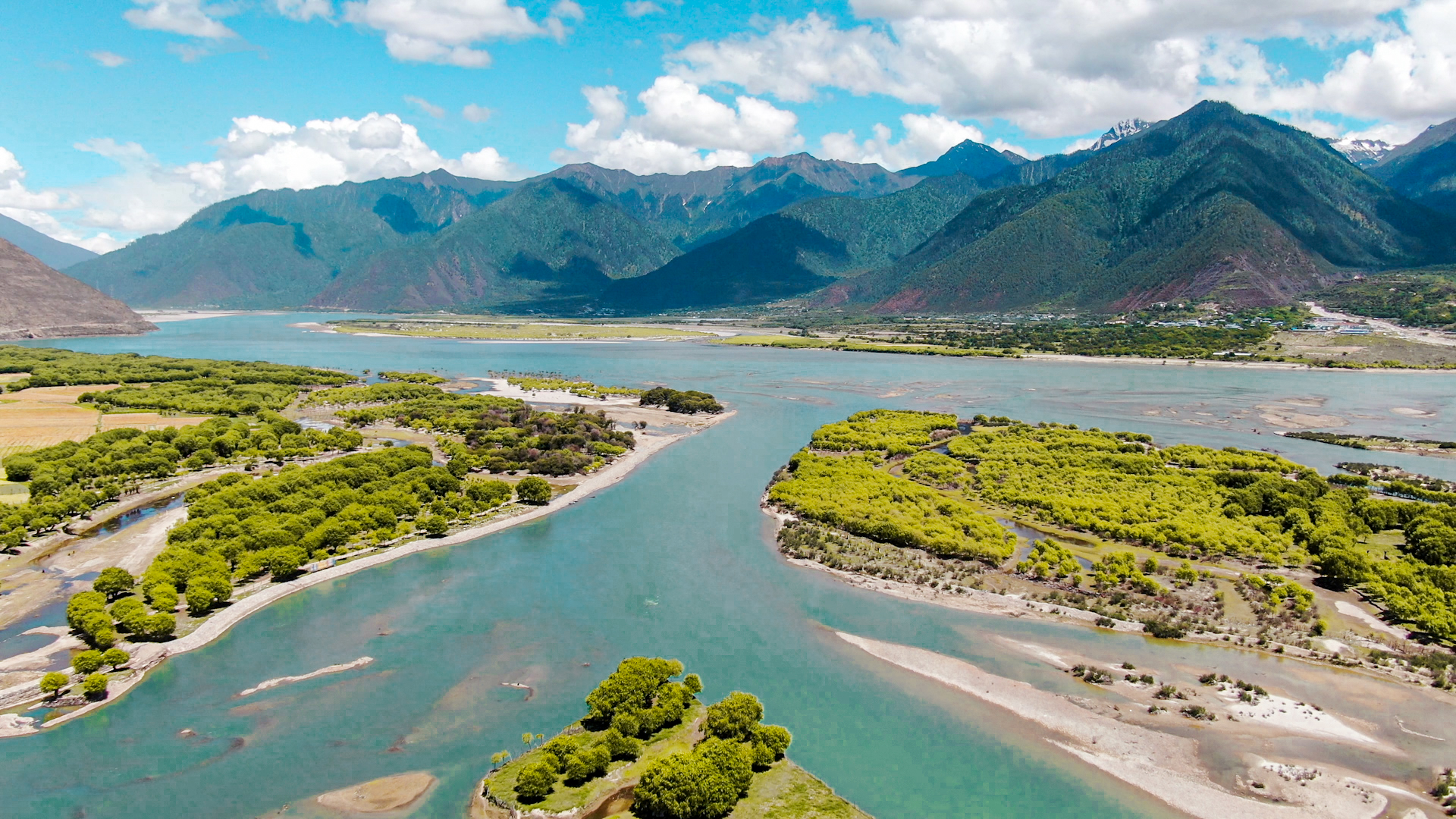
Located on the north bank of the Yarlung Zangbo River Grand Canyon in Nyingchi City’s Milin County, Suosong Village is well off the beaten track. It is a good place from which to watch the sun set over the nearby Namcha Barwa Mountain. Compared with the lively Zhibai Village, Suosong is a very quiet village surrounded by idyllic scenery. The Yarlung Zangbo River is next to the village. There is also a lush peach forest. Every spring, the peach blossoms combine with the surrounding rivers and snowy mountains in the background to make a very beautiful and picturesque scene.
-
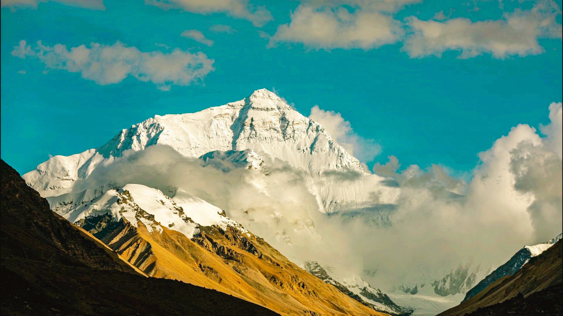
Mount Qomolangma
Mount Qomolangma, meaning “Third Goddess” in Tibetan, is located in Tingri County of Shigatse Prefecture on the China-Nepal border. With an elevation of 8,848.86m, it stands as the highest peak of the Himalayas.Highest peak in the worldThe Mount Qomolangma attraction area is surrounded by 4 peaks over 8,000m and more than 40 peaks over 7,000m. Its pyramid-shaped mountain body appears majestic and imposing.Snow-capped peaks year-roundThe mountain is flanked by three major ridges—the northeast ridge, southeast ridge, and west ridge—with three steep cliffs (north face, east face, and southwest face) nestled between them. Among these ridges and cliffs lie over 500 large glaciers, adorned with spectacular and rare ice towers, ice cliffs towering dozens of meters high, and deep crevasses. These breathtaking views come together to form the majestic “Third Pole of the Earth.” The climate here is complex and unpredictable, often changing dramatically even within a single day. Generally, the rainy season lasts from early June to September, when the likelihood of encountering heavy snowstorms is high. The best viewing periods are between April–May and September–October.This is also a great time for mountain climbing.If you’re not a trained mountaineer, visiting the attraction mainly offers distant views of the majestic Third Goddess Peak. You can spend a night at base camp to experience the 5,200m altitude, or if you’re physically fit, hike a short distance to admire the spectacular Rongbuk Glacier up close.