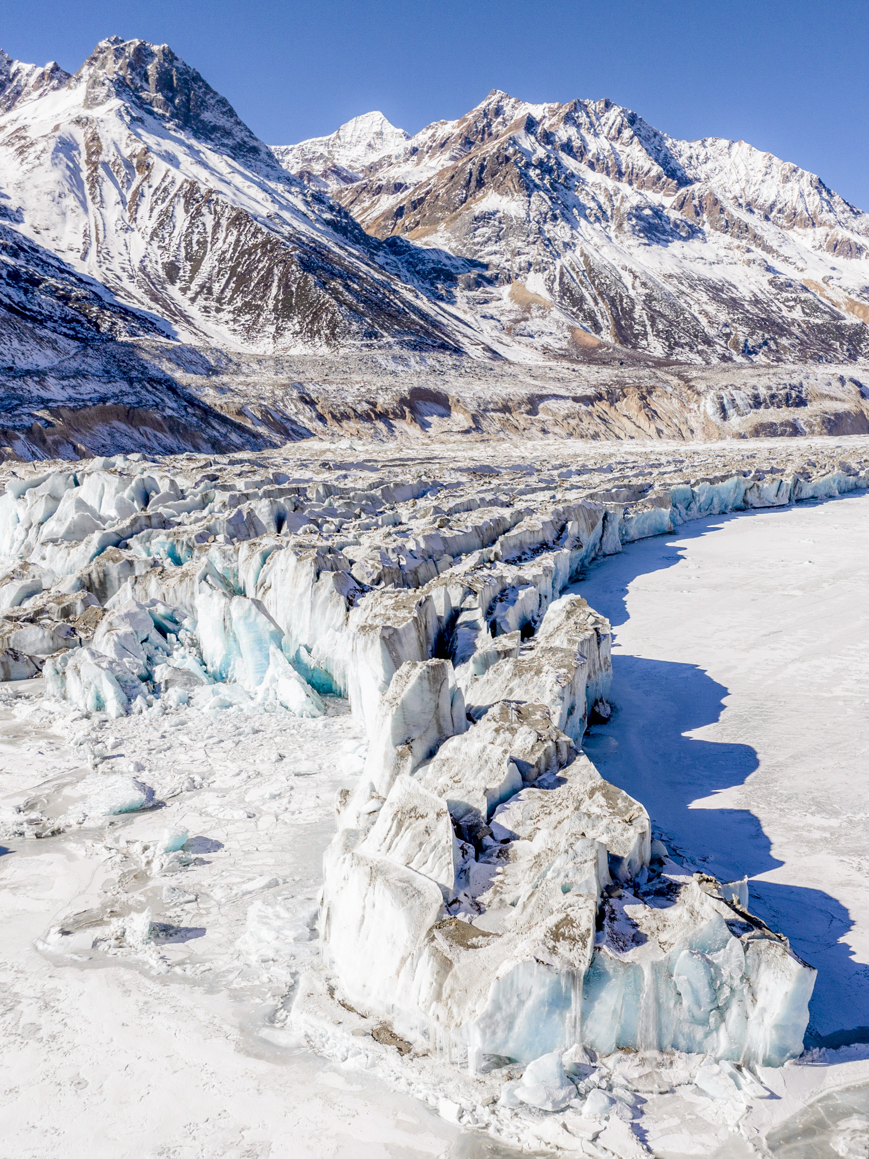
Yalong Glacier is one of the six ancient glaciers. Yalong Glacier spreads out from the main peak of Gangri Gabu Mountain at an altitude of 6,606 meters and extends to Gangri Gabu Lake at an altitude of 4,000 meters.
归档: Attractions
-
Zhire Temple
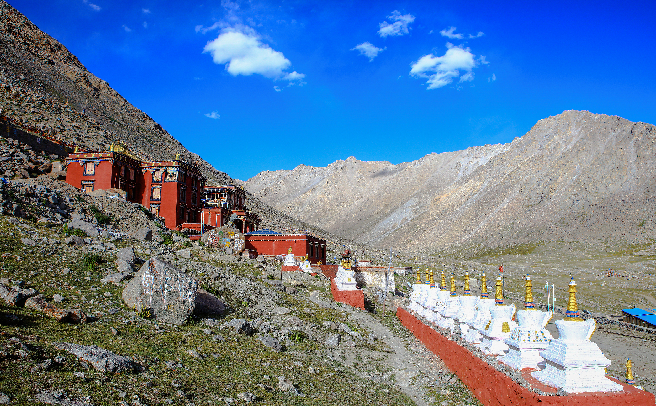
Zhire Monastery is located in Xiongba Township, Geji County, Ngari Prefecture, Tibet, at an altitude of approximately 5070 meters. Founded in 1379 by the high monk Guocangpa, it initially served as a meditation retreat and was gradually expanded into a monastery. The Tibetan word “Zhire” means “mother yak horn,” originating from a miraculous legend about the master’s ascetic practice. Built against the mountainside, the monastery features typical Tibetan architecture with red walls and golden roofs. Inside, it houses statues of Guocangpa, the Lion-faced Tara, numerous other Buddhist images, scriptures, and stupas. Surrounded by mountains and the confluence of three rivers, the monastery enjoys a serene and solemn environment. Nearby is a well-known sky burial site, making it an important religious and cultural landmark on the Ngari Plateau.
-
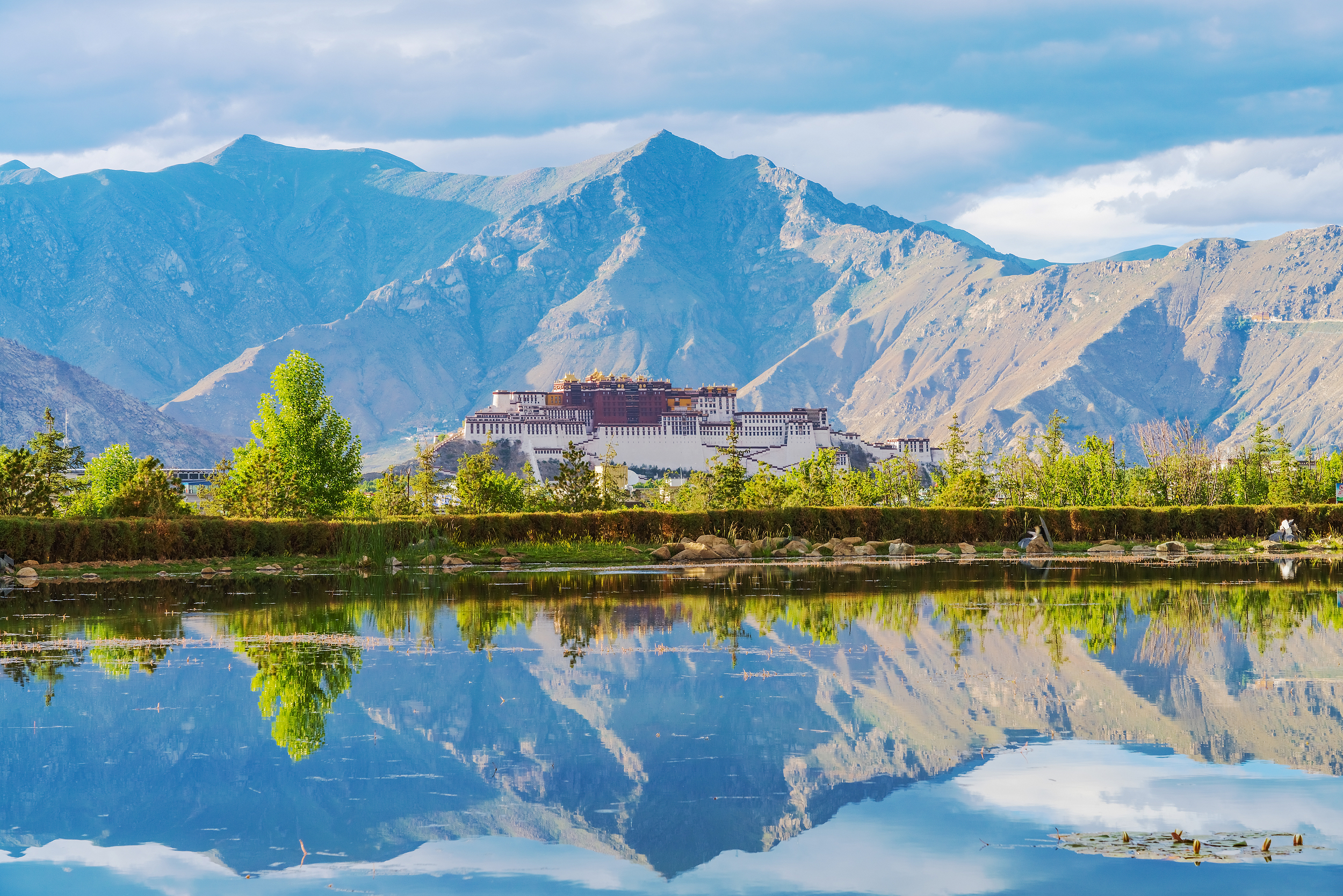
Little Budala
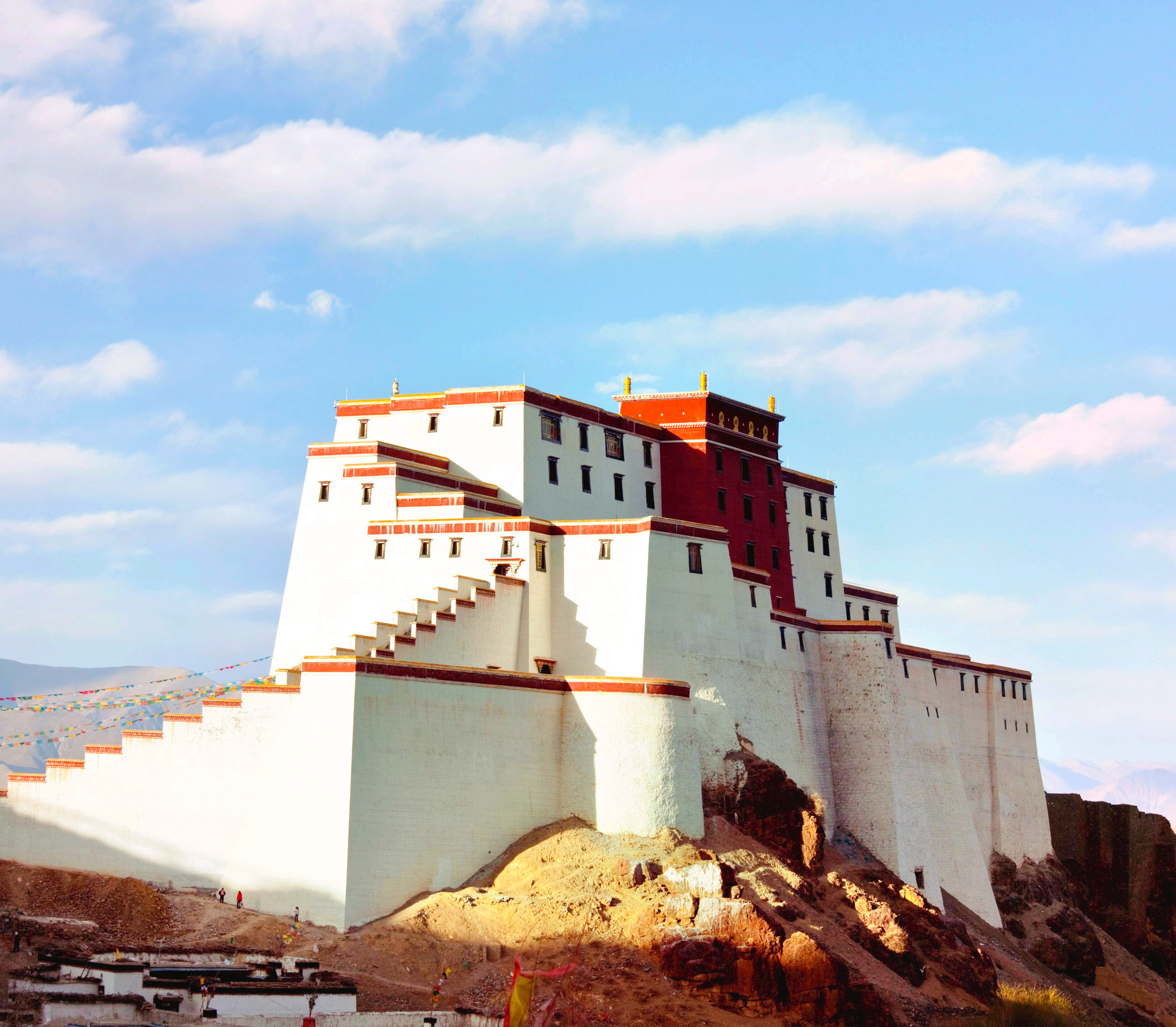
The Little Potala Palace on Zongshan Mountain, located on a hill north of downtown Shigatse, earned its name from its resemblance to the Potala Palace. From a distance, the red and white walls of the “Little Potala Palace” stand out in the sunlight, and its imposing presence is visible even from afar. It remains a landmark of Shigatse, both then and now. The Little Potala Palace, actually known as the Sangzhutse Dzong, was built in 1360 and played a significant role in history. Thirteen dzongs were constructed during the 14th and 15th centuries by the Nedong Dynasty. Due to its elevated position, the view overlooking the entire Shigatse region is exceptional.
-
“Tree of the Earth” in Ngari Prefecture
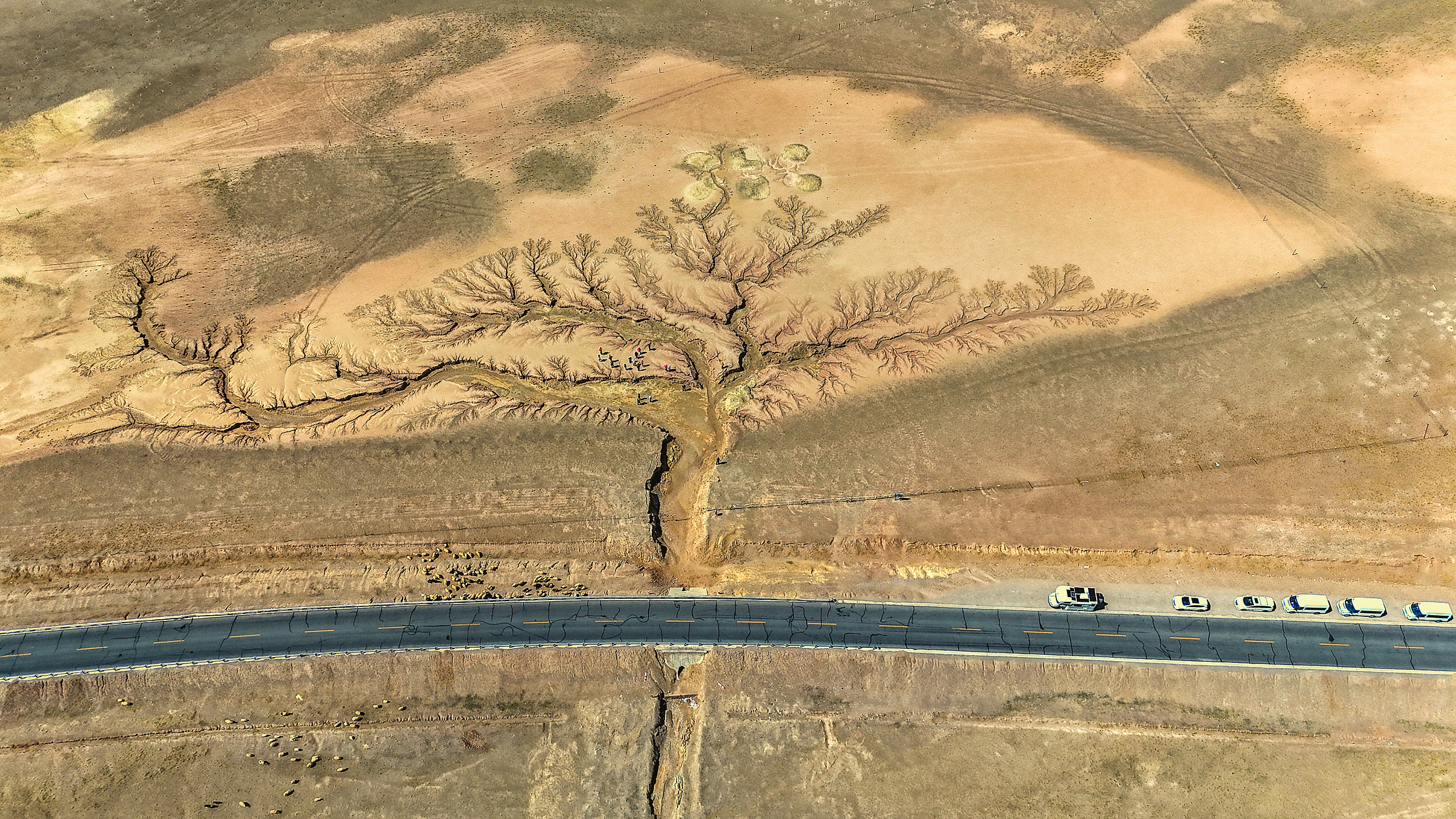
The Tree of the Land in Ngari, Tibet, is located on the southern bank of Dongcuo Lake in Quedeng Village, Dongcuo Township, Geze County, Ngari Prefecture, in the heart of the northern Tibetan Plateau, about 80 kilometers from Geze County, near the 2860th milestone of National Highway 216. This is a natural geological wonder formed by the erosion of flowing water. Over a long geological evolution, intermittent water flow eroded and deposited sediment on the surface, gradually sculpting the shape of this “towering tree”—the traces of water erosion form the trunk and branches, and even the branching points are clearly visible, with distinct textures. Viewed from the air, it resembles a forest of small trees up close, while from a distance it appears as a single, lush tree, lifelike and vivid. This landscape, a masterpiece of nature, has become a unique scenic spot on the Ngari Plateau, attracting travelers along National Highway 216 through northern Tibet to stop and admire it.
-
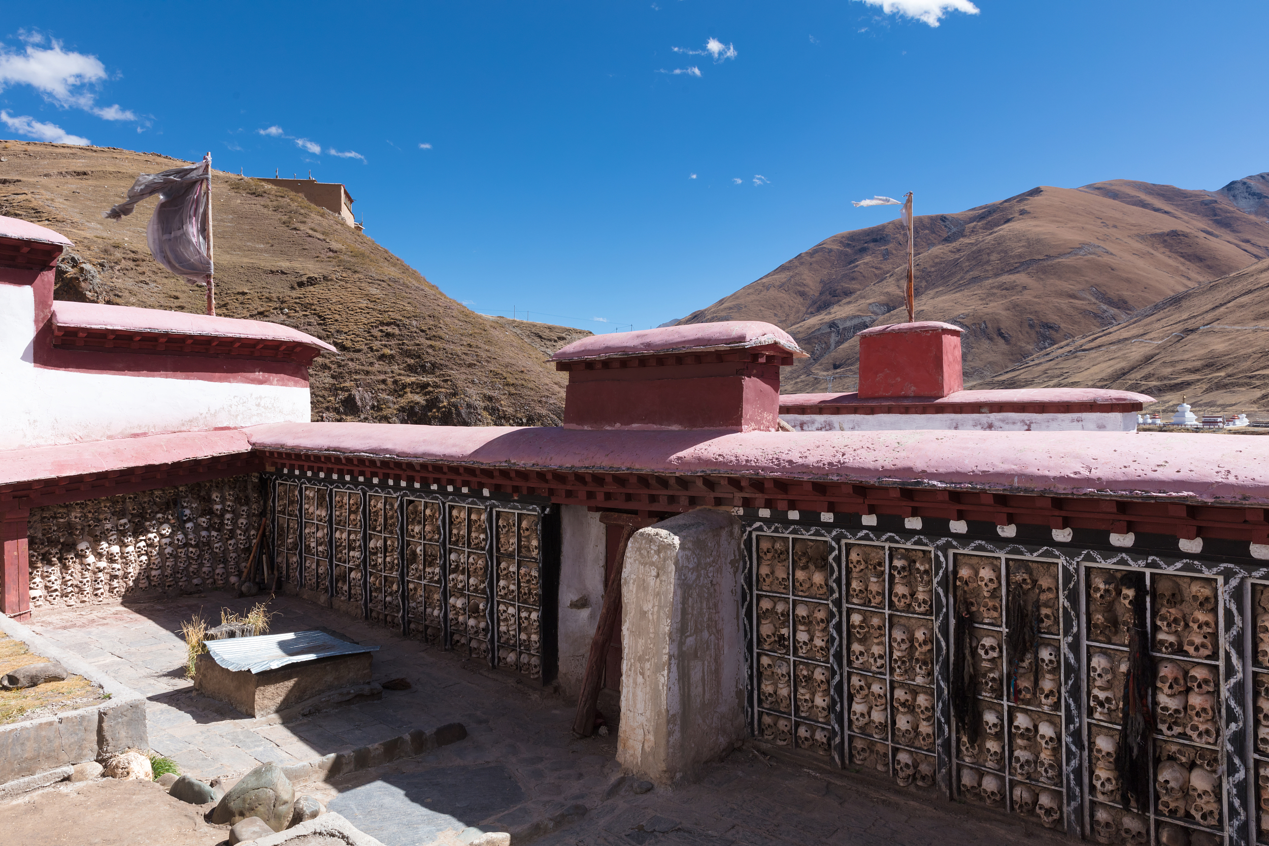
Biru Skull Wall
For example, the Skeleton Wall is located in Ru County, and there are three places, namely, the Skeleton Wall of the Dodoka Celestial Burial Platform of Damer Temple (Dharma Temple), the Skeleton Wall of the Celestial Burial Platform of Ridan Temple (partly destroyed, small scale) and the nearby missing The Skeleton Wall (destroyed) of the Celestial Burial Platform of Daiji Temple. Among them, the Skull Wall of the Dodoka Celestial Burial Platform in Damer Temple (Dharma Temple) located in Dachaqu Township is larger in scale and more famous. Therefore, for example, the Skeleton Wall mentioned here refers specifically to the Skeleton Wall on the Dodoka Celestial Burial Platform. For example, the sky burial platform where the skull wall is located is a courtyard with four walls, about 4,000 square meters. There are wooden lattices on the walls on the south and west of the courtyard. The skulls are neatly placed in the lattice. One person tall (it is said that it used to be larger, but now it is less than half of the previous size – there used to be 3 skull walls and half of the current height, which was destroyed by rain floods).
-
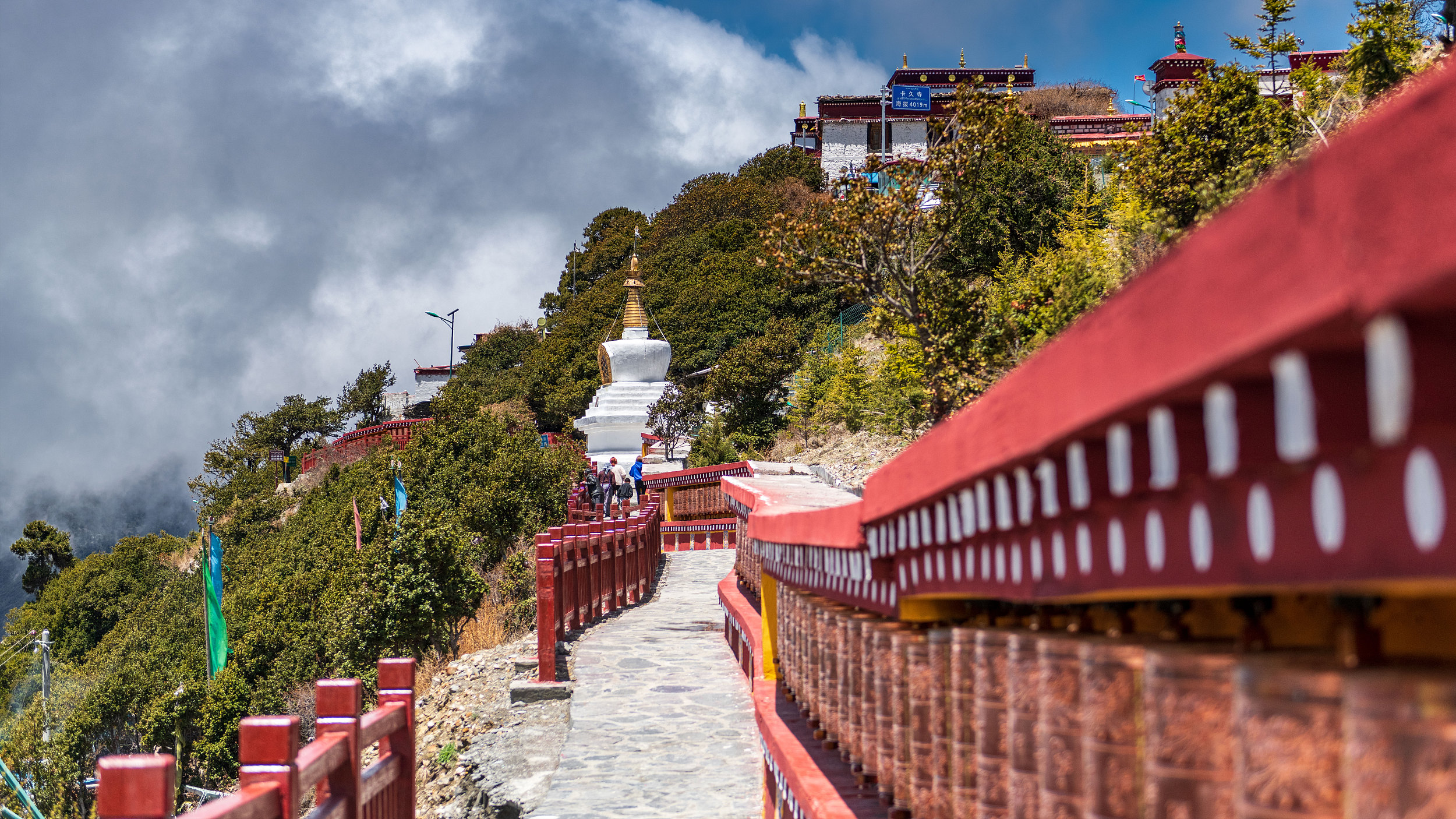
Kajiu Temple
Kajū Monastery is located in the forested peaks behind Lhakhang Town in Lhozhag County, at an altitude of approximately 3996 meters. The monastery’s full name is Kajū Jixiang Hermitage, one of the important hermitages of the Nyingma school, with a history of over 1200 years. It is the ancestral monastery where successive Ngamkhai Nyingpo Living Buddhas of the Nushi lineage studied Buddhist scriptures, researched the profound meaning of Tibetan Buddhism, and devoted themselves to spiritual practice.
-
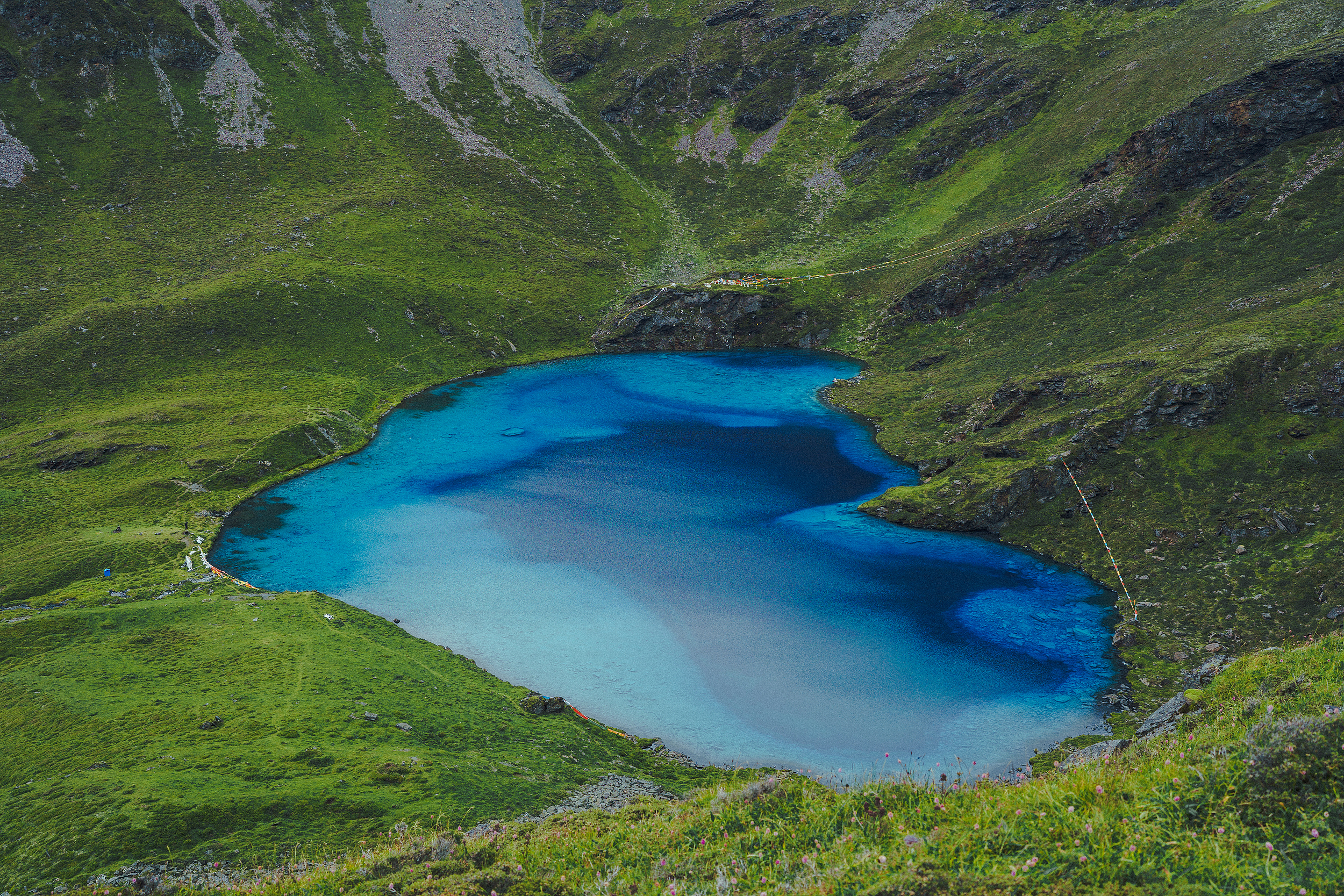
Gurula Lake
Guru La Tso, nestled deep in the Chalatuogang Snow Mountain in Cuomei County, Shannan City, is a high-altitude lake at nearly 4,800 meters above sea level, renowned for its clear, azure waters and unique natural shape. Because the lake’s outline, appearing almost heart-shaped, is nestled among mountain gorges, locals and tourists alike often call it “Heart Lake,” a name that adds to its unique charm. Hidden among snow-capped mountains and peaks, Guru La Tso’s waters are a deep sapphire blue, surrounded by vast alpine meadows, shrubs, and diverse alpine vegetation, making it an ideal destination for photographers and attracting numerous hikers seeking to experience the magnificent natural landscape. The beauty of Guru La Tso lies in its contrast: such a gentle and romantic form, yet situated at such a rugged and desolate altitude. This awe-inspiring experience, measured only by footsteps, makes every visitor feel that the journey was worthwhile.
-
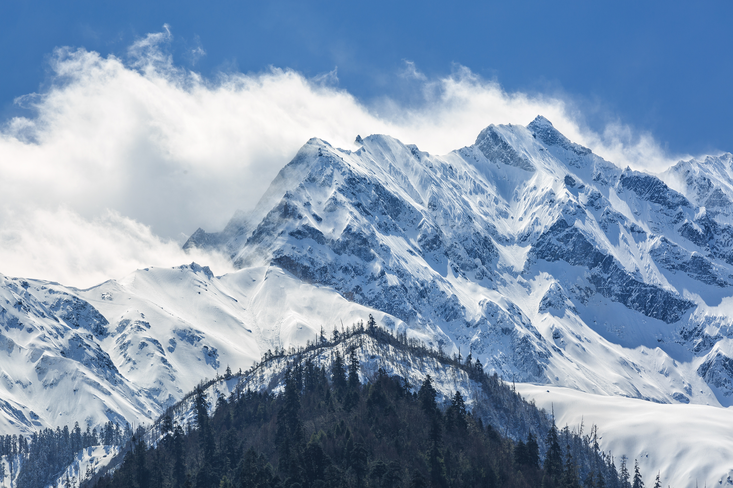
Himalayas
The Himalayas, the Tibetan language means “the hometown of snow”. Located on the southern edge of the Qinghai-Tibet Plateau, it is the highest mountain range in the world, with more than 110 peaks reaching or exceeding 7,350 meters above sea level. The natural borders of countries such as , Pakistan and other countries start from Nanga-Parbat Peak in the west and Nanga Bawa Peak in the east, with a total length of about 2450km and a width of 200-350km. The main peak is Mount Everest, the highest peak in the world, which means the third goddess in Tibetan, with an altitude of 8844.43 meters. According to research, the altitude of Mount Everest increases by an average of 1 cm per year.
-
Yani National Wetland Park
Yani National Wetland Park is located in Nyingchi, with the river surface at an altitude of about 2,920 meters. It is a must-go place for Nyingchi to the Yarlung Zangbo Grand Canyon. The glass viewing platform in the park can overlook the confluence of the Niyang River and the Yarlung Zangbo River. There is a sign on the platform that says “You must drive 318 in this life”. If you choose to take a boat tour, you can watch the different colors of the confluence of the two rivers up close, and you can also appreciate the scenery on both sides of the river. The south bank is the Himalayas, and the north bank is the sacred mountain of Benri.
-
South Hill Park
Nanshan Park is very large, and the overall planning of the scenic area is complete, with rockery, waterfalls, lakes, wooden plank roads, and all the facilities for leisure tourism.