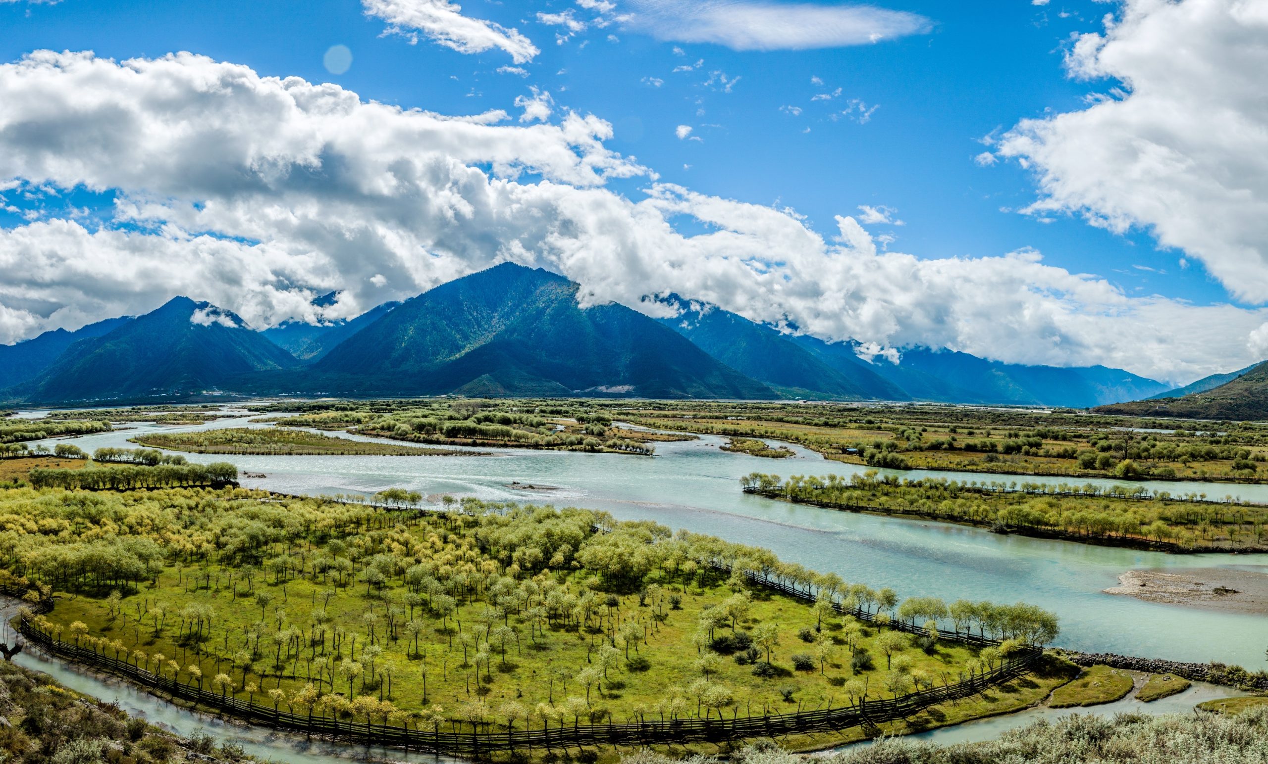
The Niyang River originates from the west side of Mila Mountain and joins the Yarlung Zangbo River on the south side of Bayi Town. It is the main river in Gongbujiangda County and Bayi District. The river is just beside the 318 National Road, driving on this section of the 318 National Road, accompanied by the river all the way. The landscape around the Niyang River is beautiful, with continuous plateaus and mountains and rivers along the way, especially the area near the Yarlung Zangbo Grand Canyon downstream is very beautiful. In the upper reaches of the Niyang River, there is also a famous landscape that is the mainstay, where tourists usually stop to take pictures.
归档: Attractions
-
Sa’gya Temple
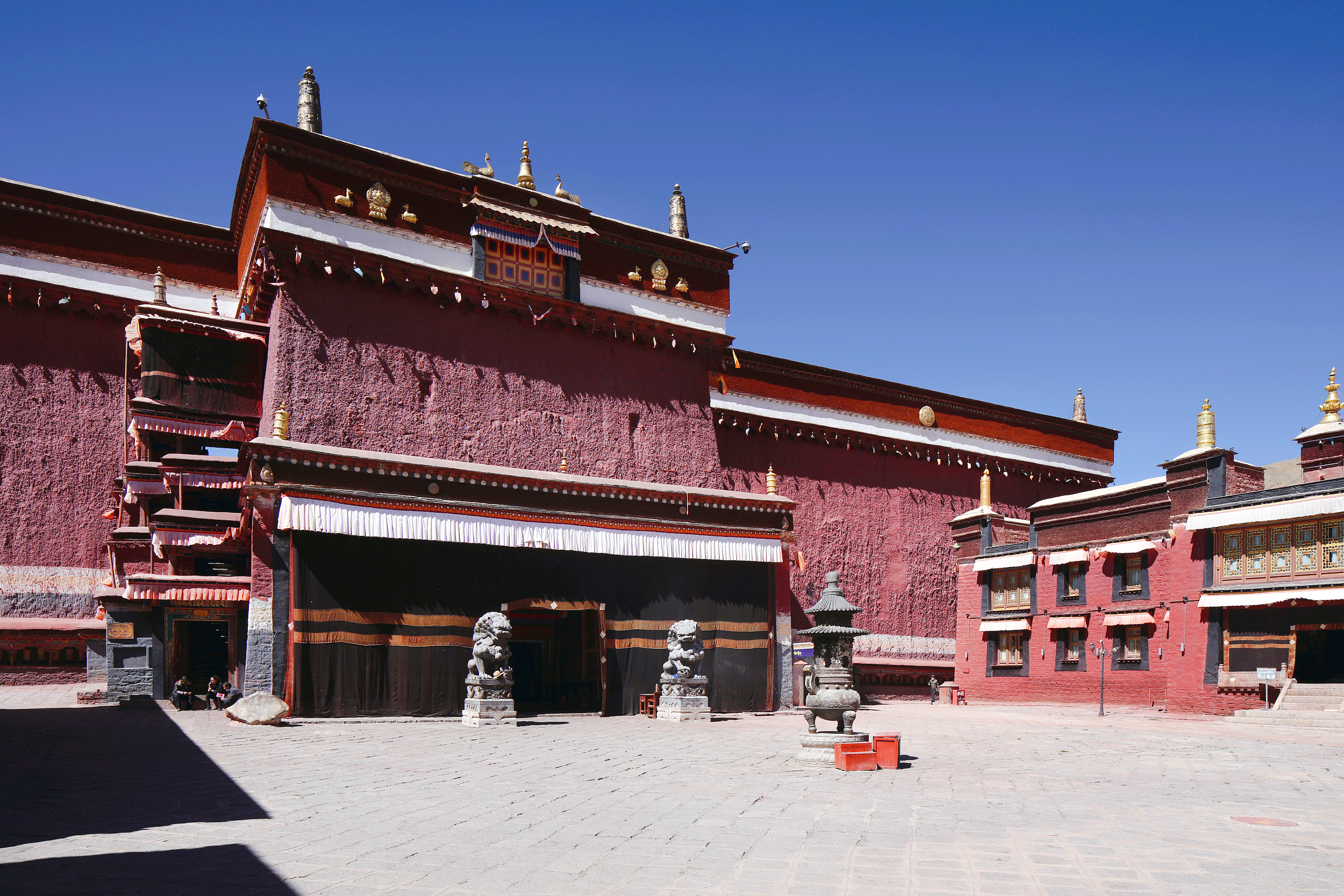
Sakya Monastery is the main monastery of the Sakya sect of Tibetan Buddhism. Divided into two temples, north and south, with the Zhongqu River as the boundary, the North Temple is located in front of Benbo Mountain on the north bank and has suffered huge damages. The Sakya Monastery seen now is the Nan Monastery. There are many treasures and many cultural relics in the temple, especially the murals of the Yuan Dynasty. Sakya Monastery is not only magnificent and beautiful in architecture, but also contains a large number of cultural relics of considerable artistic value, such as seals, classics, Buddha statues, etc. There are four rare treasures in Sakya Monastery, namely, Kampot Guru (a statue of a goddess who was invited from India by Zhuqingbaiwaba), Langjie Qudan (a pagoda built by the great translator Pabailuozawa, The pagoda often comes out of water and is regarded as Shenshui), the statue of Manjushri (the deity statue of Saban, it is said that the door of wisdom can be opened by reciting the seven astronomical sutras in front of the statue), the statue of Yukamu Tara (the worship of Ba Siba) Three of the Four Treasures are Buddha statues. Sakya Monastery has more than 3,000 exquisite murals with a wide range of themes, involving religion, history, culture and social life. Auspicious animals, decorative patterns, etc., the scene is grand and rich in content.
-
Galongla Snow Mountain
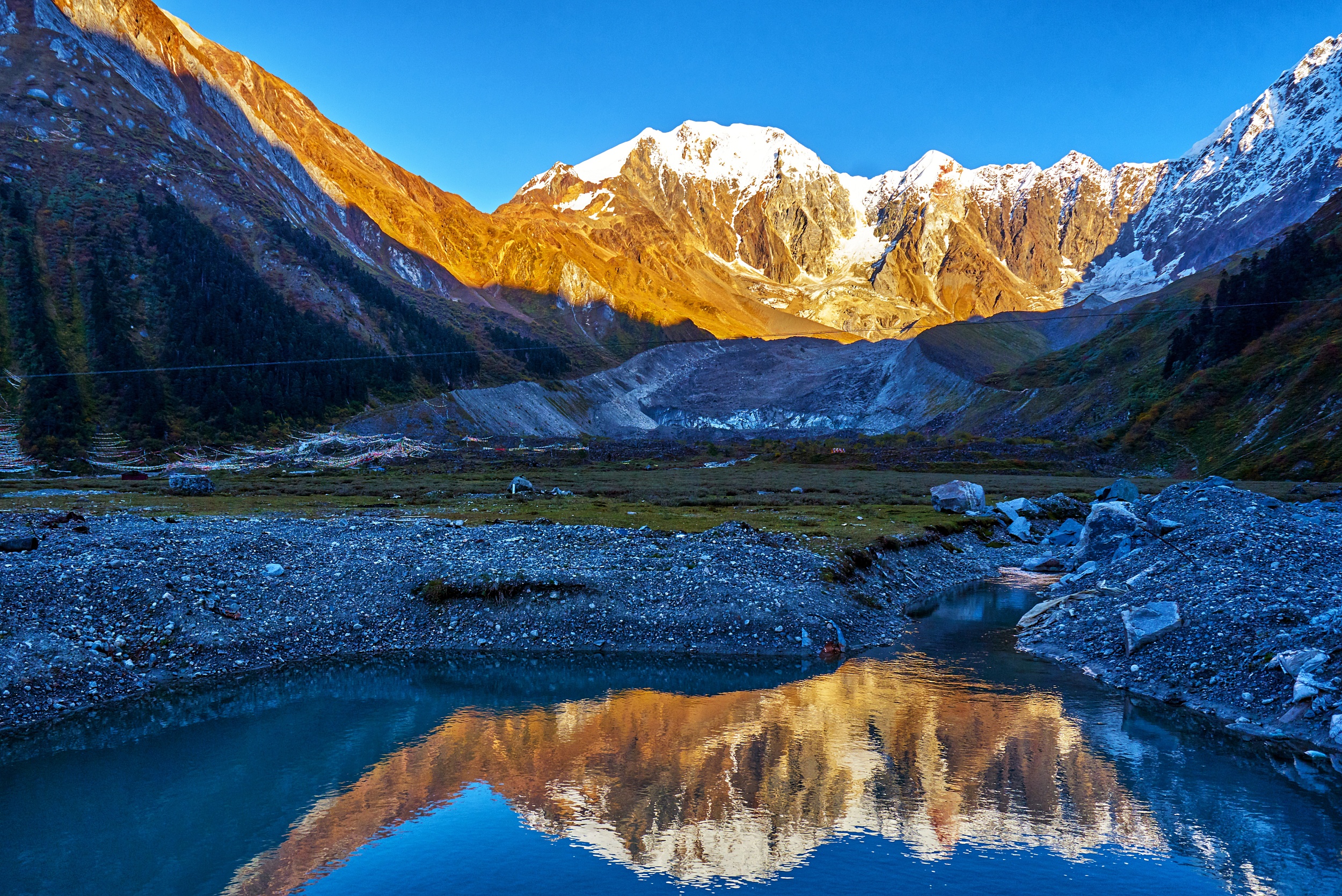
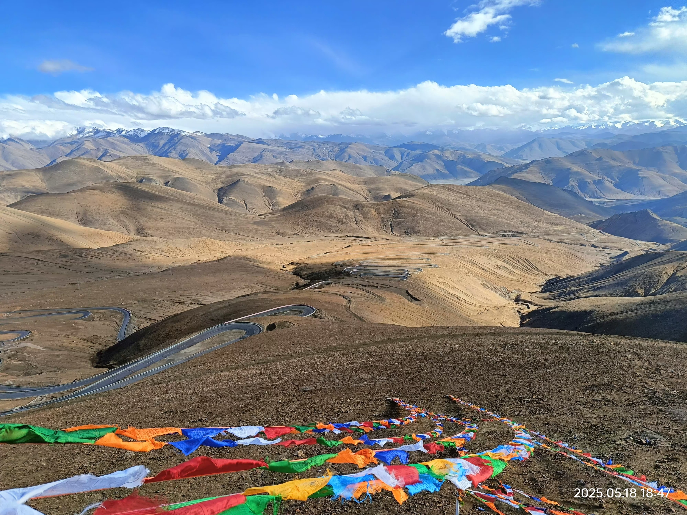
Galungla Mountain, with an average altitude of 4,800 meters, is a must-pass mountain for driving into Medog. The terrain is steep and complex. The average thickness of the snow on the top of the mountain is 5 to 6 meters. After the snow melts from June to September every year, pedestrians can pass. The rest of the time, the roads are covered with snow, the paths are indistinguishable, the depth is unpredictable, and the road is impassable, and the mountain is completely closed. To this day, Medog is still called “the plateau island” by the outside world. Galungla Mountain is located on the windward slope of the Himalayas. Affected by the warm climate of the Indian Ocean, the climate is changeable and daunting. In addition, the geological structure is complex and the activities are violent and frequent. Avalanches, landslides, and mudslides may occur at any time. Locals call it the mountain. The top of the mountain is covered with snow and ice all year round, and there are several glaciers on the mountain. After the glaciers melt, they flow into the tributaries of the Brahmaputra. There are glacial lakes formed by melting ice and snow on the top of the mountain, as well as alpine meadows. The wildflowers on the mountain are gorgeous and dazzling, with typical modern glacial landforms.
-
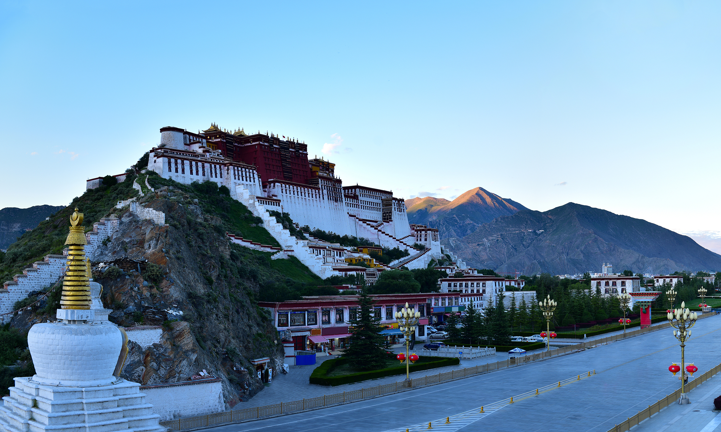
Yaowang Mountain Viewing Platform
At sunrise and sunset, there will be many tourists and tourists on the viewing platform setting up their tripods and waiting here. The cloth palace from this angle is beautiful if you press the shutter.
-

Rongbuk Temple at Mount Everest Base Camp
Rongbuk Monastery, the full name of “Laduicha Rongbudong Aqulin Temple”, is located at the end of the Rongbu Glacier at the foot of Mount Everest, with an altitude of 5,150 meters. The entire temple is built on the mountain, with a total of 5 floors, and only two floors are still in use. The temple is divided into two parts, the old and the new. The old temple is close to Mount Everest. The temple contains the practice cave where Padmasambhava practiced in the past, as well as the stones and pagodas with the footprints of Padmasambhava. The new temple was built in 1902 with a nunnery under it. From the temple to the south, it is a good position to watch Mount Everest, especially the Manidui and the White Pagoda at the entrance of the temple, which are often used by tourists as the prospect of shooting Mount Everest.
-
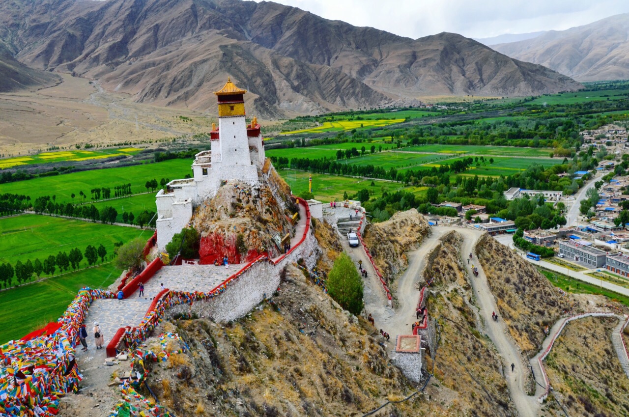
Yungbulakang Palace
“Yongbu” means doe in Tibetan, and it is named after the mountain of Tashi Ci Ri, which looks like a doe; “Lakang” means temple. There is a spring called “Gar Spring” about 400 meters northeast of Tashi Ci Ri Mountain. It flows all year round. It is said that this spring can cure all diseases. Most people who come to Yongbulakang to worship come here to drink water and purify themselves.It is said that Yongbulakang is the palace where the first Tibetan king Niechi Zamp lived, and it has a history of more than 2,000 years. Yongbulakang is divided into two parts. The front part is a three-story building with more than ten stone steps on the first floor. The front half is the entrance hall, and there is a small platform with eaves outside the hall. From the entrance hall to the inside is the Buddha Hall, which enshrines the statues of the Three Buddhas and successive Zamps. In addition, there are statues of Princess Wencheng, Princess Bhrikuti of Nepal, and two Tibetan ministers, Thunmi Sambhota and Lu Dongzan, which are exquisitely shaped and very vivid. The second floor is also divided into two parts, the front part is a platform surrounded by low walls on three sides, and the back part is a corridor with a patio. The back part is a square high-rise fortress watchtower, connected to the front part, both built of stone, towering and majestic. The south slope is gentle, and you can spiral up from the bottom of the mountain. There are dozens of stone steps in front of the palace gate. Initially, Yongbulakang was just a small palace. After expansion, it gradually became a Buddhist temple.
-
Jiacuola Mountain Pass
Gyatsola Pass, also known as Dingrijie, is 5,220 meters above sea level. It is the pass of Mount Everest Nature Reserve. The huge protected area sign is erected on the road, and countless prayer flags flutter in the wind. When the weather is clear, standing on the Gyatso La Pass, you can not only see Mount Everest, but also three other peaks, Cho Oyu, Lhotse and Makalu, all above 8,000 meters above sea level. From the same pass, you can see four extreme peaks of the order of 8,000 meters, which is rare among the passes over the 318 line and even all highways in the world.
-

Gala Peach Blossom Village
Gala Peach Blossom Village is located about 5-6 kilometers to the southeast of Bayi Town, Nyingchi, near Gala Village. Along the countryside and hills on both sides of the Niyang River, there are dense peach blossoms in full bloom, which are decorated in clusters of greenery. On the meadow, the scenery is intoxicating and very popular with photographers. Around the end of March every year, it is very suitable to visit Gala Peach Blossom Village. This is the time when the peach blossoms are in full bloom. The Peach Blossom Festival in Nyingchi is usually held at this time, and there are often some special activities such as folk performances.
-
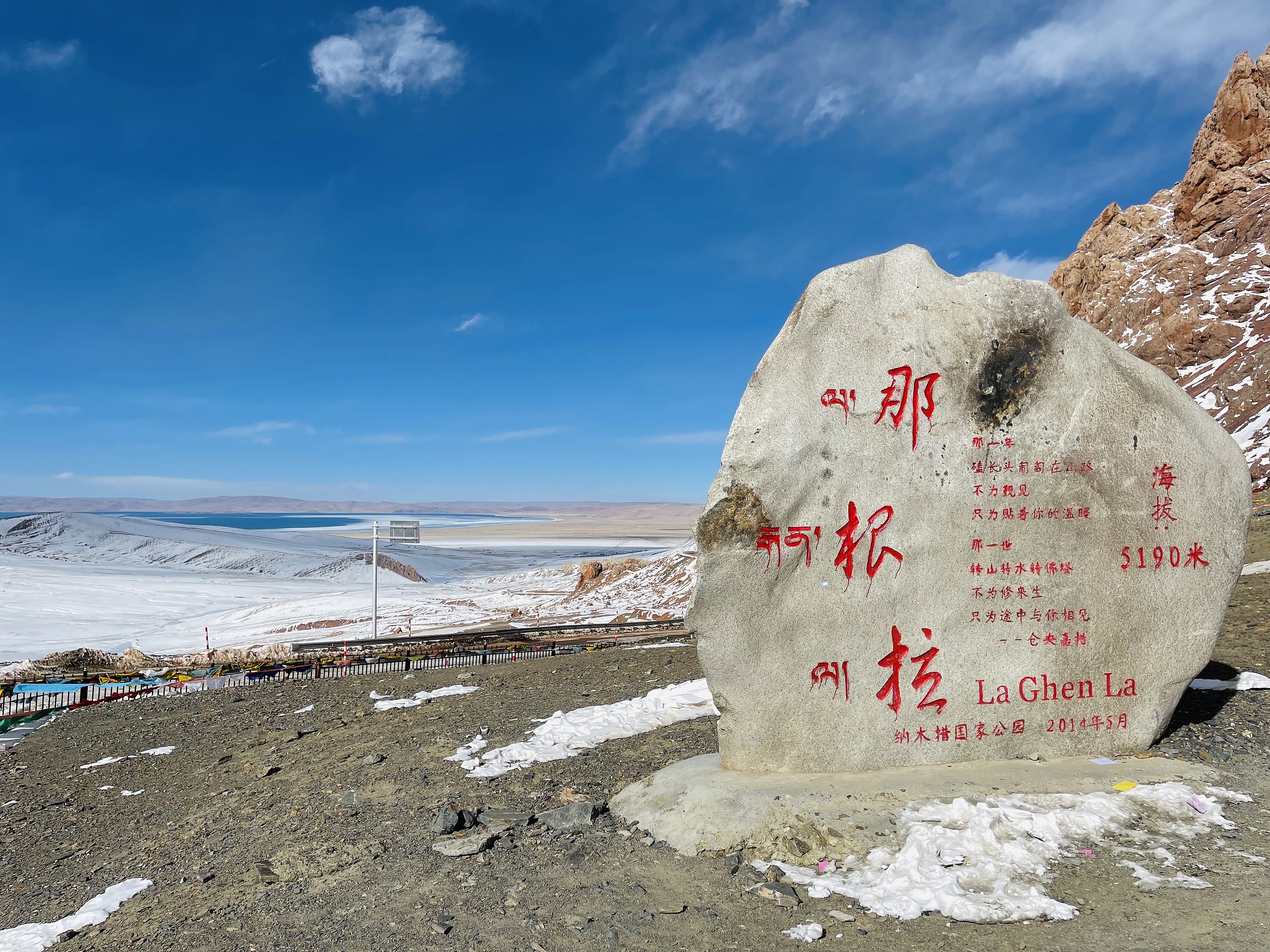
La Ghen La
Nagenla Pass, located in Damxung County, Tibet, is the only place to go to Namtso. Nagenla Pass, in the Nyainqentanglha Mountains, with an altitude of 5,190 meters, a stone tablet indicating the altitude was erected at the pass, and prayer flags were hung on the Mani pile, because in the hearts of Tibetans, every pass is a sacred place , the hanging prayer flags represent the reverence for the gods. The temperature at Nagenla Pass is particularly low. Friends who travel to Namtso should bring their own down jackets, and masks are also necessary. Standing on the mountain pass and looking to the north, you can overlook the beautiful Nam Co.
-
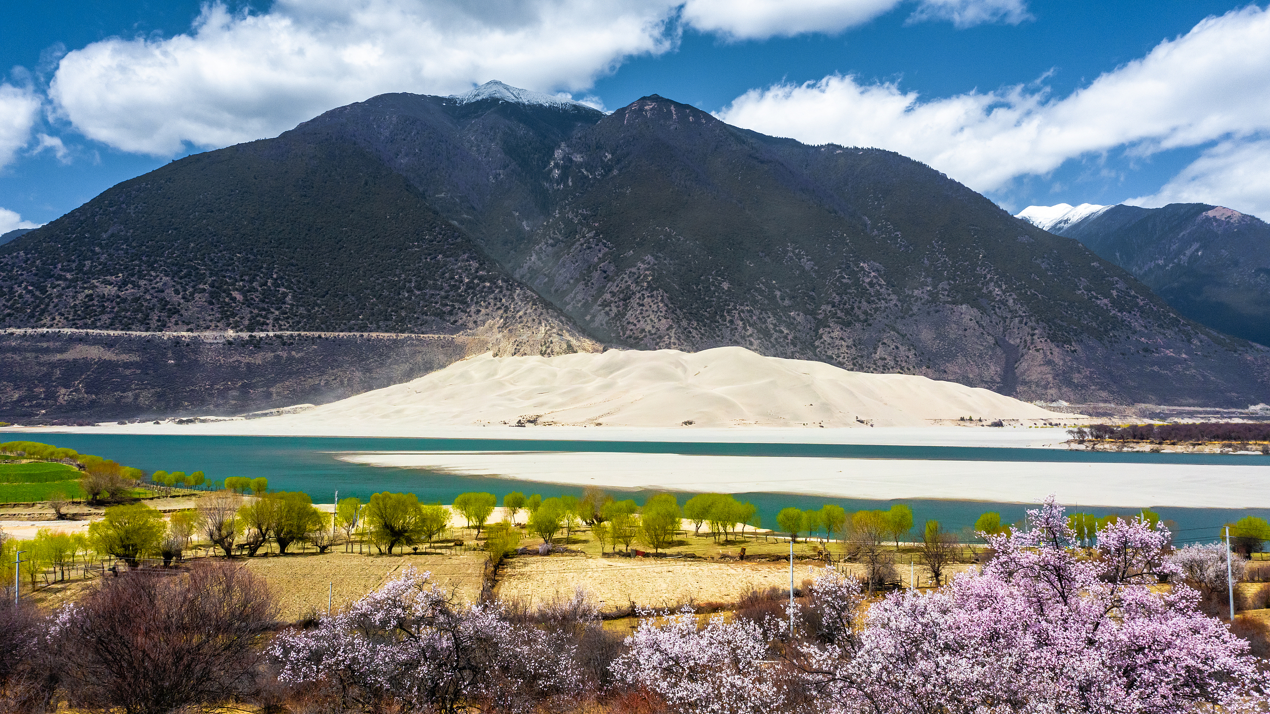
Buddha Palm Dune
The Buddha Palm Sand Dune is located on the north bank of the Yarlung Zangbo River in Daniang Township, Milin County. And viewing the dunes is free, the viewing platform is on the side of the road, and there are public toilets, so most tourists will get out of the car to see when they pass by.